Texas Braces for Enhanced Severe Storm Threat with Large Hail and Damaging Winds Sunday
TL;DR Summary
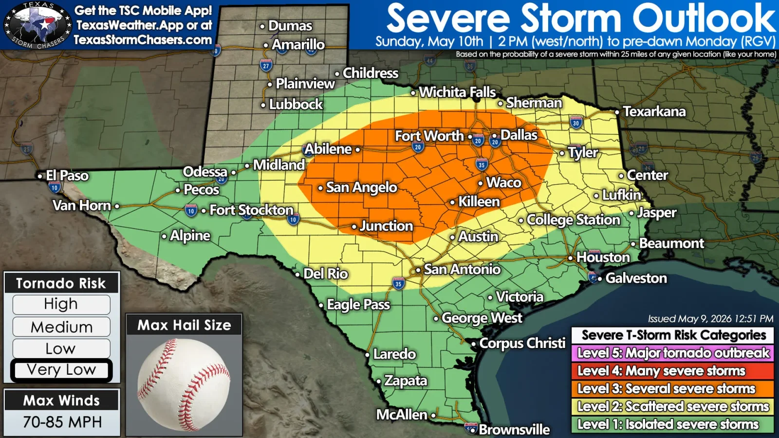
An Enhanced Risk (Level 3/5) of severe storms is forecast Sunday across parts of Texas as a cold front moves south, with large to very large hail (potentially 2 inches or more) and damaging straight‑line winds up to about 70 mph; tornado risk remains low but not zero. The most intense storms are expected in West-Central to North Texas, the Hill Country, and the DFW/Waco areas, with timing mainly Sunday afternoon into Sunday night, then East Texas Sunday evening into overnight. Residents should secure outdoor items, move vehicles under cover, charge devices, and monitor alerts, as travel could be hazardous Sunday evening.
- Very Large Hail, Damaging Winds Possible in Texas on Sunday Texas Storm Chasers
- Cold front to bring severe storm, hail risk across Texas Sunday San Antonio Express-News
- Isolated strong storms, higher severe risk tomorrow KXAN Austin
- MOTHER’S DAY: Sun & Heat before evening Storm chances KSAT
- Weather Impact Alert | Severe storms possible Sunday evening KVUE
Reading Insights
Total Reads
0
Unique Readers
15
Time Saved
2 min
vs 3 min read
Condensed
81%
546 → 102 words
Want the full story? Read the original article
Read on Texas Storm Chasers