Lala Downgrades to Tropical Storm, Big Island Braces for Winds and Flooding
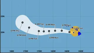
Tropical Storm Lala, downgraded from hurricane and located about 105 miles west-northwest of Kailua-Kona, continues to bring damaging winds, heavy rain and flash flooding to the Big Island as it moves northwest; a flash flood warning is in effect through Sunday morning with rain rates up to 1.5 inches/hour and 10–17 inches already observed on the eastern Big Island, with another 5–10 inches possible across the island and Maui County; a tropical storm warning remains, and coastal surge up to 3 feet is possible along east-facing shores.