
2026 Hurricane Season Split: Record Calm in Atlantic, Hyperactive Pacific Driven by El Niño and Ethiopian Drought
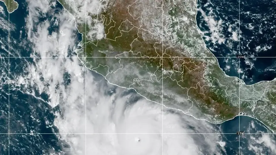
The 2026 hurricane season is defined by extreme imbalance: the Atlantic has produced only seven tropical storms and zero hurricanes, while the Pacific has generated 18 named storms and eight hurricanes. This divergence is attributed to a powerful El Niño event and a severe drought in Ethiopia, which disrupted tropical wave formation. The Atlantic’s accumulated cyclone energy is at its lowest since 1925, whereas the Pacific’s activity is far above average, with Hurricane Polo reaching 180 mph winds.
Key points
- Atlantic activity is historically low, with only seven named storms and no hurricanes formed by late September, compared to the typical 14-15 named storms and 7-8 hurricanes.
- The Pacific has seen 18 named storms and eight hurricanes, with accumulated cyclone energy at 235, nearly double the typical 108 for this time of year.
- A severe drought in Ethiopia, with rainfall deficits of 40-70% in June and July 2026, reduced the formation of tropical waves that often originate in the Ethiopian Highlands and cross the Atlantic.
- El Niño has created high vertical wind shear in the Atlantic, suppressing storm development, while simultaneously providing warm waters and low shear in the Pacific, fueling rapid intensification.
- Tropical Storm Fay in the Atlantic may have briefly reached hurricane strength on September 20, but official records list its peak winds at 70 mph; a post-storm review is pending.
- Hurricane Nolo is approaching Hawaii in late September, and Hurricane Polo reached 180 mph winds in the Pacific, illustrating the stark contrast in storm intensity between the two basins.
Background
Previous coverage in September 2026 highlighted El Niño’s role in suppressing Atlantic activity, noting a record-long lull of over 100 days without a hurricane. Earlier reports indicated that the Pacific season was already above average, with major storms like Genevieve and Karina forming, while the Atlantic remained quiet due to wind shear. The current situation confirms these trends, with the Atlantic’s inactivity reaching historic lows and the Pacific’s activity continuing to surge.
Why it matters
The 2026 season underscores how climate phenomena like El Niño and regional droughts can drastically alter hurricane patterns, creating dangerous imbalances between ocean basins. The lack of Atlantic hurricanes may provide temporary relief for coastal communities, but the hyperactive Pacific poses significant risks to Hawaii and other Pacific regions. Understanding these dynamics is crucial for improving forecast accuracy and preparing for future climate shifts that may alter traditional hurricane patterns.
What to watch
Forecasters expect the Atlantic season to remain subdued, though late-season storms could still form near the Gulf and Southeast U.S. The Pacific may see two more named storms by early October. A post-storm review of Tropical Storm Fay will determine if it briefly reached hurricane strength. NOAA and other agencies will continue monitoring tropical waves originating in Africa to assess their potential to develop into storms in either basin.
- Hurricane season is broken. Two oceans are historically out of whack USA Today
- Hurricane season maps tracker: latest forecasts and more The Weather Channel
- Record El Niño has Atlantic hurricane season doing something remarkable Bring Me The News
- Tropical Storm Fay strengthens as Atlantic season breaks 112-year record Sun Sentinel
- The Pacific is churning with hurricanes. The Atlantic is quiet. Blame El Niño npr.org
Want the full story? Read the original reporting
Read on USA Today