
Satellite imagery reveals 82% of Gaza's structures damaged as war enters third year
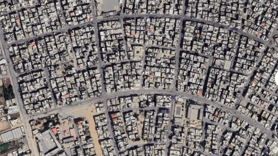
Newly updated satellite images from Google Maps and a brief lapse in Israeli government mapping services reveal the scale of destruction in the Gaza Strip three years after the war began in October 2023. Approximately 82% of structures, or roughly 200,000 buildings, have been damaged, with two-thirds completely destroyed. The UN Satellite Centre reports a 9% increase in destroyed structures since the ceasefire began nearly a year ago. Over 74,000 Palestinians have been killed, and agricultural land in northern Gaza is 94% damaged. Key sites, including the port of Gaza City and the Jabalia refugee camp, are reduced to rubble, while displaced populations remain concentrated in areas like Al-Mawasi.
Key points
- UNOSAT reports a 9% increase in destroyed structures in Gaza since the ceasefire began nearly a year ago.
- Approximately 82% of Gaza's structures, totaling about 200,000 buildings, have been damaged, with two-thirds completely destroyed.
- More than 74,000 Palestinians have been killed and over 175,000 injured since the war began in October 2023.
- Northern Gaza has suffered 94% damage to cropland, while Khan Younis recorded the highest number of damaged structures at 51,885.
- A brief error on Israel's official mapping service revealed unblurred satellite imagery of military bases and destruction in northern Gaza before being corrected.
Background
This development follows ongoing international scrutiny of the conflict, including a recent US approval for a $2.8 billion bomb sale to Israel and diplomatic tensions over the ceasefire hub. Earlier reports highlighted the recovery of remains from rubble and Israel's first criminal probe into a specific civilian killing, underscoring the persistent humanitarian crisis and accountability challenges.
How outlets are covering it
Al Jazeera emphasizes the comprehensive destruction across all governorates, citing UN data and Google Maps imagery to highlight the erasure of neighborhoods and agricultural land. The Independent corroborates the scale of devastation through updated Google Earth imagery, focusing on the visual evidence of widespread ruin. Middle East Eye highlights a specific incident where Israel's official mapping service briefly exposed unblurred satellite imagery of military bases and destruction in northern Gaza, noting that the government quickly restored blurring. While all sources agree on the extent of damage, Al Jazeera and The Independent focus on the humanitarian and structural impact, whereas Middle East Eye focuses on the military and informational aspects of the conflict.
Why it matters
The scale of destruction in Gaza, with 82% of structures damaged and significant agricultural land destroyed, underscores the long-term humanitarian and economic impact of the conflict. The continued destruction despite a ceasefire highlights the ongoing challenges to peace and reconstruction, while the brief exposure of military bases raises questions about transparency and the military's presence in the region.
What to watch
The situation in Gaza is likely to remain tense, with ongoing concerns about the ceasefire's durability and the potential for further military operations. International pressure may increase for accountability and reconstruction efforts, while the military's presence and the destruction of infrastructure will continue to shape the humanitarian crisis and diplomatic relations.
- Satellite images show Gaza in ruins three years into Israel’s genocidal war Al Jazeera
- Google Earth exposes devastation in Gaza with new updated images The Independent
- Israel accidentally exposes Gaza military bases and widespread destruction on official map middleeasteye.net
- Google Updates Gaza Satellite Images: What Pictures Show Newsweek
- Reported impact snapshot | Gaza Strip (23 September 2026) at 15:00 ReliefWeb
Want the full story? Read the original reporting
Read on Al Jazeera