Satellite imagery reveals scale of destruction from Venezuela’s twin quakes
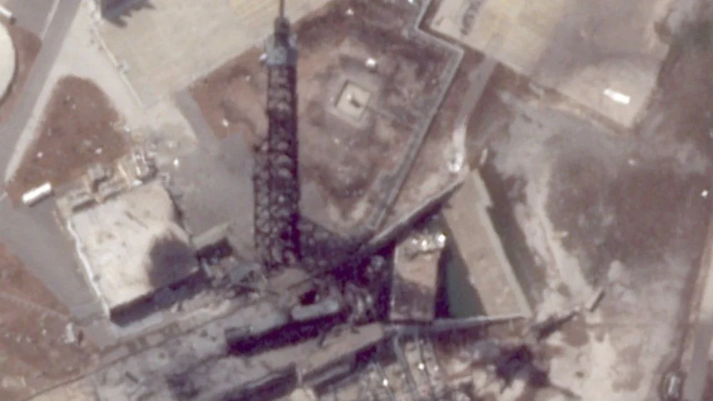
Two powerful earthquakes measuring 7.2 and 7.5 struck near San Felipe, Venezuela on June 24, killing at least 1,430 and leaving more than 51,000 missing, with over 300 aftershocks reported. The first 72 hours are critical for rescuers as the death toll is expected to rise. Satellite imagery shows widespread damage in Caraballeda and Macuto, including collapsed high-rises and seafront buildings, while La Guaira is heavily affected and airports remain closed as rescue operations focus on Caraballeda.