
Satellite shows Mexico City's rapid ground subsidence
TL;DR
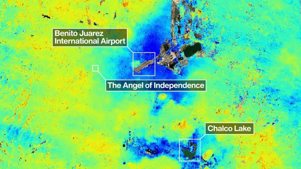
Mexico City is sinking at as much as 14 inches (35 cm) per year due to groundwater pumping and the weight of its sprawling urban area atop an ancient lakebed. NASA–ISRO’s NISAR satellite—a dual-frequency radar mission launched in 2025—now monitors surface changes with centimeter precision, revealing subsidence patterns across the city and demonstrating the mission’s capability to track ground movement globally.
- Mexico City is sinking up to 14 inches per year, satellite images show Space
- One of the planet’s biggest cities is sinking so rapidly it’s visible from space CNN
- Mexico City is sinking so quickly, it can be seen from space AP News
- Mexico City is sinking. This NASA satellite just found out by how much BBC Sky at Night Magazine
- Environment - Mexico City is sinking so quickly, it can be seen from space Seattle DJC.com
Want the full story? Read the original reporting
Read on Space