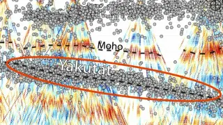
ML maps Alaska's hidden Yakutat edge, linking quakes to a deep subducted microplate
A machine-learning study analyzes 2018–2021 seismic data to map a 250-km, razor-sharp edge of the Yakutat microplate beneath Alaska, extending under the North American plate and along the Denali fault. This hidden edge illuminates how the subducted slab shapes stress and earthquake nucleation in the region, including the 2002 magnitude-7.9 Denali quake, and suggests a broader, dynamically interacting plate boundary that influences regional volcanic activity.