SWOT unmasks a global tidal footprint of rivers
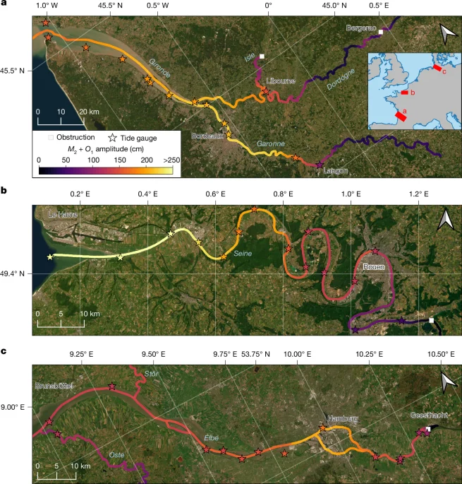
Using the SWOT satellite’s wide-swath altimetry, researchers mapped tidal elevations across 3,172 coastal rivers and identified over 165,000 km of tidal reach on 51,627 river branches, revealing that tides influence hundreds of millions of people and many waterways. Tidal amplitudes at river mouths, channel slope, width, and human-made obstacles shape how far tides propagate upstream, with dams notably limiting tidal extent in about 16% of rivers. The study, validated against 622 tide gauges and supported by the RiverSP dataset, provides a global atlas of tidal rivers, enabling improved flood/drought analysis, saltwater intrusion prediction, and hydrologic–ecologic modelling for coastal water security under climate change.