
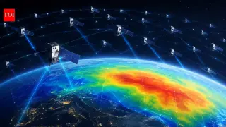
Kyoto University uses 1,200 Starlink satellites to map Earth's thermosphere via tomography
Researchers at Kyoto University have utilized publicly available orbital data from approximately 1,200 Starlink satellites to create the first two-dimensional map of Earth's thermosphere at an altitude of roughly 482 kilometers. By applying tomographic techniques similar to medical CT scans, the team analyzed orbital drag to estimate atmospheric density variations across different latitudes and longitudes. This method offers a cost-effective alternative to dedicated monitoring satellites and aligns with existing data from the European Space Agency's Swarm mission, potentially improving collision avoidance in increasingly crowded low Earth orbit.

