
California faces second storm Sunday as El Niño drives coastal waves and Sierra snow
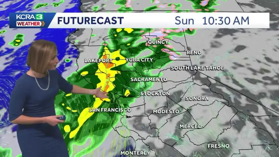
A second storm system is expected to bring rain and snow to Northern California starting Sunday morning, following the season's first major weather event. While precipitation will be lighter and slower than Friday's storm, it will last longer, with chain controls likely on mountain roads. A third, potentially more intense storm is forecast for Wednesday, while the broader pattern is influenced by strengthening El Niño conditions and unusually warm ocean waters.
Key points
- The second storm will move from northwest to southeast on Sunday, bringing light to moderate rain to Northern California.
- Rain is expected to reach the San Joaquin Valley by Sunday evening, with snow levels dropping to 6,500 feet overnight.
- Chain controls may be required on I-80, Highway 50, and Highway 88 from Sunday night into Monday morning.
- A third storm is forecast for Wednesday, potentially bringing heavier rain, gusty winds, and significant snowfall.
- El Niño is strengthening, contributing to warmer ocean temperatures and increased wave heights along the California coast.
Background
This weather activity follows the season's first major storm, which impacted California late Friday night. The current pattern is part of a broader trend influenced by El Niño, which has historically led to wetter winters in California. Previous archive entries do not provide relevant background for this meteorological event.
How outlets are covering it
KCRA emphasizes the local impact on Northern California, noting that the second storm will be lighter but longer-lasting than Friday's, with a third storm potentially being the biggest snow producer. The New York Times highlights the statewide implications, including huge waves up to 60 feet at Mavericks and the influence of El Niño on sea levels and rainfall distribution. OpenSnow focuses on snow accumulation in the Pacific Northwest, noting that snow levels are dropping to 3,500–4,000 feet, though this source is less relevant to the California-specific forecast.
Why it matters
The upcoming storms will replenish reservoirs and reduce wildfire risks but pose significant travel hazards due to chain controls and dangerous coastal conditions. The strengthening El Niño suggests a wetter winter, which could impact infrastructure and emergency preparedness across California.
What to watch
A brief dry period is expected on Tuesday, followed by a third storm on Wednesday that may bring heavier precipitation. Forecasters will provide more details on the timing and intensity of this storm in the coming days.
- One storm down, two to go: Here's what to expect this weekend in NorCal KCRA
- California Could Face 50-Foot Waves as Storms Slam Its Coast The New York Times
- Northern California storm impacts: Latest updates on chain controls KCRA
- El Niño strengthening as wet weather hoses down the West; more rain on the way KTLA
- Cooler weekend storms bring snow, but how much? OpenSnow
Want the full story? Read the original reporting
Read on KCRA