
New Mexico faces multi-day flash flood threat from Hurricane Polo remnants
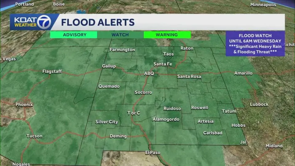
A statewide flood watch is in effect for New Mexico as remnants from Hurricane Polo and Tropical Storm Odalys bring heavy rain and flash flood risks through Tuesday. The National Weather Service warns of 1 to 4 inches of rainfall, with some areas potentially receiving up to 6 inches, exacerbating already saturated ground conditions from recent storms.
Key points
- Flood watch issued for all of New Mexico through Tuesday night, covering areas including Albuquerque, Santa Fe, and the Rio Grande Valley.
- Remnants from Hurricane Polo are expected to enhance monsoonal flow, causing showers and thunderstorms to move from western to eastern New Mexico.
- Rain totals could range from 1 to 4 inches, with some areas potentially receiving up to 6 inches, increasing the risk of flash flooding in creeks, streams, and low-lying areas.
- The ground is already saturated from previous flooding, raising the risk of excessive runoff and potential road closures.
- ABC News reports a level 3 of 4 flood threat for parts of the Southwest, including New Mexico, with 4 to 6 inches of rain possible in some areas.
Background
New Mexico has experienced significant flooding in recent weeks, including three deaths in the Navajo Nation in mid-September. Hurricane Polo, which previously reached Category 5 status, is now expected to make landfall in Baja California, with its remnants impacting the Southwest. The state has also seen record rainfall in September, with Albuquerque recording 3.31 inches of rain, marking the second wettest September on record.
How outlets are covering it
KOAT and KOB 4 emphasize the local impact of Hurricane Polo's remnants on New Mexico, highlighting the risk of flash flooding and road closures. ABC News provides a broader Southwest perspective, noting the level 3 flood threat and the potential for 4 to 6 inches of rain in some areas. The Santa Fe New Mexican focuses on the statewide flood watch and the need for preparedness. All sources agree on the severity of the incoming rainfall and the potential for significant flooding, but ABC News provides a wider regional context, while KOAT and KOB 4 focus more on local impacts.
Why it matters
The combination of saturated ground and heavy rainfall from Hurricane Polo's remnants poses a significant risk of flash flooding, road closures, and potential damage to property. The National Weather Service's flood watch and the level 3 flood threat from ABC News underscore the severity of the situation, requiring residents to be prepared for potential emergencies.
What to watch
Residents in New Mexico should monitor local weather alerts and be prepared for potential flash flooding, road closures, and other weather-related disruptions. The National Weather Service will continue to update forecasts and warnings as the situation evolves. Residents should also be aware of the potential for high water levels in rivers and streams through Friday, as noted by KOB 4.
- Flood watch issued for all of New Mexico as Hurricane Polo brings impacts to the state KOAT
- Statewide flood watch in effect as New Mexico braces for more rainfall Santa Fe New Mexican
- Heavy rain to raise flooding concerns again this week in New Mexico KOB 4
- Life-threatening flash flooding heading to Southwest, including Texas, New Mexico ABC News - Breaking News, Latest News and Videos
- From New Mexico flooding to Oklahoma rain and tornado risk, dangerous weather grips the region KOCO
Want the full story? Read the original reporting
Read on KOAT