
Severe Weather Threat Grows for Friday Across Midwest and Beyond
TL;DR Summary
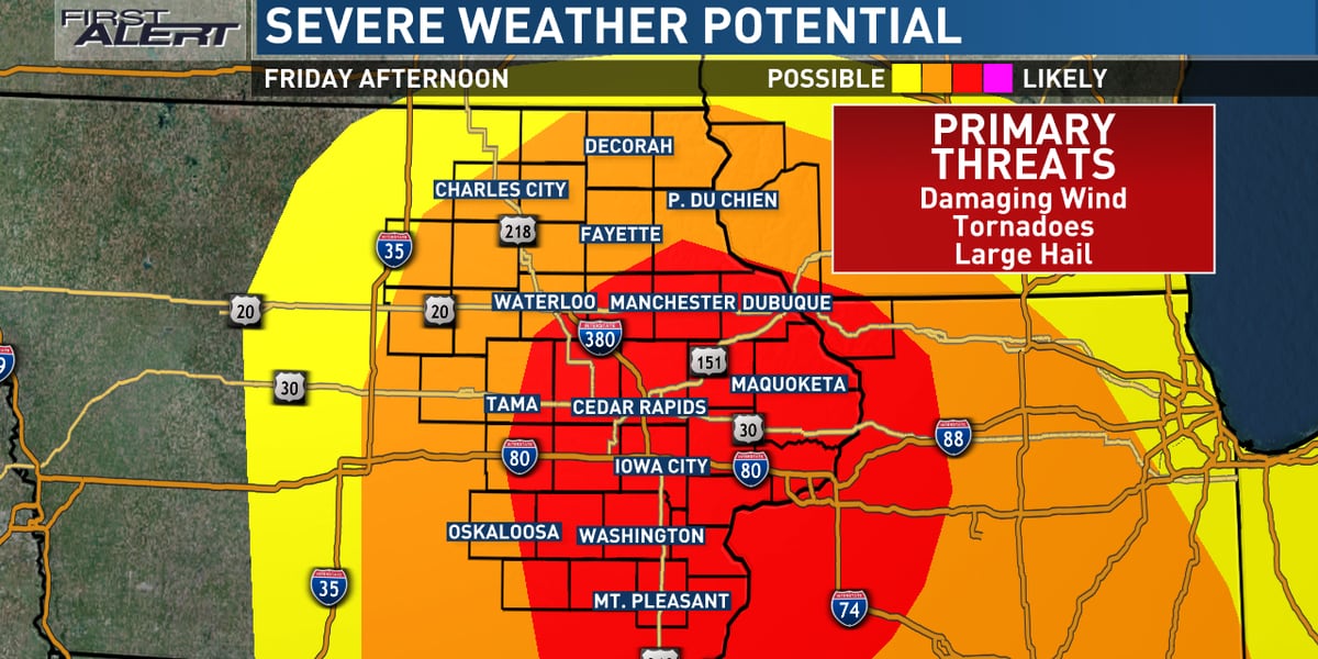
A warm front will bring scattered showers and a big temperature spread to eastern Iowa today, with highs ranging from the upper 40s to mid-60s. A few thunderstorms are expected tonight, but the severe risk is low. However, severe weather is still expected for Friday, with a fast-moving line of severe storms predicted to bring damaging winds and several tornadoes between 3 pm and 8 pm. Residents are urged to stay up to date with the latest forecast and have a plan in place for severe weather warnings.
- Warmer and windy today, severe potential continues to increase for Friday KCRG
- More Than 60 Million May Be Impacted By Severe Storms By Late Week FOX Weather
- TRACKING: Severe threats increase for Friday PM | Top Stories | kwwl.com kwwl.com
- Thursday's relative calm precedes substantial severe weather risk Friday KCRG
- Severe weather possible near St. Louis Friday KTVI Fox 2 St. Louis
- View Full Coverage on Google News
Reading Insights
Total Reads
0
Unique Readers
8
Time Saved
1 min
vs 2 min read
Condensed
61%
226 → 88 words
Want the full story? Read the original article
Read on KCRG