
Stalled Front and Tropical Moisture Trigger Record Rain and Floods in Central Plains
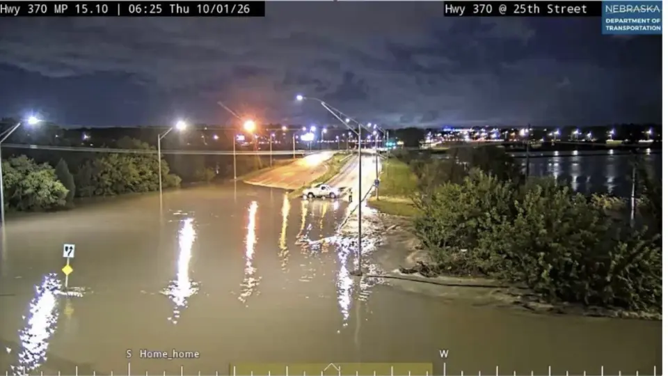
A slow-moving frontal boundary is interacting with moisture from former Hurricane Polo, Hurricane Rachel, and the Gulf of Mexico, causing repeated 'training' thunderstorms and record-breaking rainfall across the Central Plains. Lincoln, Nebraska, recorded its wettest day in 139 years, while flash flood warnings remain active from Texas to the Midwest.
Key points
- Multiple moisture sources, including remnants of Hurricane Polo and Hurricane Rachel, are converging with a stalled front in the Central Plains.
- The slow movement of the front allows thunderstorms to repeatedly track over the same areas, a phenomenon meteorologists call 'training.'
- Lincoln, Nebraska, recorded 6.15 inches of rain on Sept. 30, 2026, breaking its previous daily record of 5.45 inches set in 1910.
- Flood watches extend from the Texas-Mexico border through the Dallas-Fort Worth area to just south of Oklahoma City.
- The heavy rainfall has improved drought conditions in the Southwest and central U.S., according to NOAA's Drought.gov.
Background
This event follows a series of Pacific moisture events in September that caused flooding in the Southwest and New Mexico. The current situation is distinct from the East Coast flooding reported on Oct. 1, which was driven by Gulf and Caribbean moisture. The current Central Plains flooding is specifically linked to the remnants of Hurricane Polo and the broader Pacific moisture environment associated with Hurricane Rachel.
How outlets are covering it
Yale Climate Connections emphasizes the meteorological mechanism of 'training' thunderstorms and the multi-source nature of the moisture (Polo, Rachel, Gulf). It highlights the record-breaking rainfall in Nebraska and the potential for agricultural disruption. WOAI focuses on the immediate local impact in the San Antonio area, noting a flood watch for Bexar County and the Hill Country, with isolated pockets of 6 to 8 inches of rain expected late Thursday into Friday. Both sources agree on the severity and the role of tropical moisture, but Yale provides a broader national context and historical comparison, while WOAI focuses on the localized threat in Texas.
Why it matters
The event demonstrates how post-landfall tropical systems can continue to cause significant inland flooding through moisture transport. The record rainfall in Nebraska and the widespread flood warnings highlight the vulnerability of the Central Plains to such weather patterns, with potential impacts on agriculture, infrastructure, and public safety. The improvement in drought conditions is a positive outcome, but the immediate risk of life-threatening flooding remains high.
What to watch
Forecasters expect the heavy rain and thunderstorms to continue across the Central Plains through Friday. The National Hurricane Center is monitoring a new disturbance in the eastern Pacific, with a 70% chance of development into a tropical cyclone by mid-to-late week. The Atlantic hurricane season is currently quiet, with no tropical activity forecast for the next seven days.
- Tropical moisture, stalled front fueling flood threat across the Central Plains Yale Climate Connections
- UT San Antonio leadership closely monitoring weather conditions UT San Antonio Today
- Flood risk continues into Friday as cold front arrives KXAN Austin
- Polo's historic moisture plume expands flood threat into Texas The Weather Channel
- LIVE | Heavy rainfall with isolated pockets of 6 to 8 inches WOAI
Want the full story? Read the original reporting
Read on Yale Climate Connections