3D Subsurface Map Reveals Hidden Pathways Threatening U.S. Power Grids
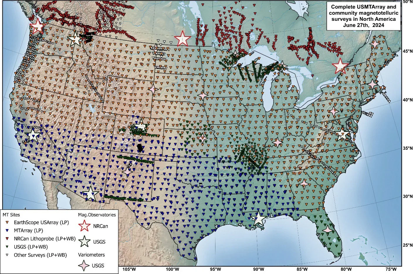
A two-decade study using 1,800 magnetotelluric stations yields the United States Magnetotelluric Array, a first large-scale 3D map of underground electrical properties. It shows complex geoelectric structures that can drive damaging currents during solar storms, potentially threatening electrical grids. The data improve hazard assessment and feed NOAA/USGS real-time risk maps, moving beyond older 1D models and aiding future prediction and resource exploration.