
Curiosity Rover Captures Unbalanced Dawn Panorama of Mysterious Martian Yardangs
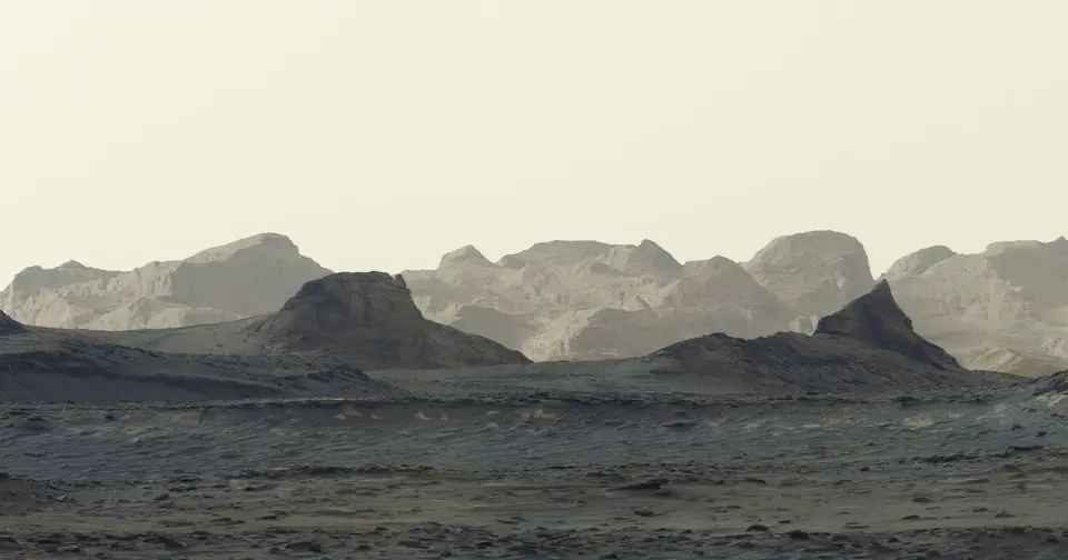
NASA’s Curiosity rover has released a new panoramic image of wind-carved cliffs known as yardangs on Mount Sharp, captured during Martian dawn on August 11, 2026. The image, processed without white balancing to preserve the early morning light, highlights a geological layer that scientists find puzzling due to its color and angle. The rover, which has climbed over 1 kilometer since landing in 2012, aims to reach this specific layer by 2027 or 2028 for detailed analysis.
Key points
- The panorama was captured on August 11, 2026, during Curiosity’s 4,982nd sol on Mars, using the Mastcam instrument.
- The image shows wind-carved cliffs called yardangs on the northwestern portion of Mount Sharp, a mountain rising roughly three miles above the floor of Gale Crater.
- NASA processed the panorama without white balancing to preserve the appearance of the early morning scene, including blue tones in the foreground.
- The yardang layer is estimated to be about three billion years old and appears distinct from the main sequence of geological layers on Mount Sharp.
- Curiosity has reached an elevation gain of about 1 kilometer, the greatest height any rover has climbed on Mars, and aims to reach the yardang layer by 2027 or 2028.
Background
Curiosity landed in Gale Crater in 2012 and has been climbing Mount Sharp since 2014. The mountain’s geological layers provide evidence of changing conditions on Mars over time, including ancient lakes and streams. The yardang layer is believed to have been added after an interval of erosion, rather than forming as part of the mountain’s original sequence.
How outlets are covering it
PetaPixel emphasizes the artistic and scientific value of the unbalanced panorama, highlighting the mysterious nature of the yardang layer. NASA Science focuses on the rover’s progress and the geological significance of the yardangs, noting that the layer may have been added after an interval of erosion. Both sources agree on the importance of the yardang layer but differ in their emphasis, with PetaPixel focusing on the visual aspects and NASA Science on the geological context.
Why it matters
The yardang layer provides insights into the geological history of Mars and the processes that shaped its surface. Understanding the origin of this layer could help scientists better understand the planet’s climate and geological evolution. The rover’s progress in climbing Mount Sharp also demonstrates the capabilities of robotic exploration on Mars.
What to watch
Curiosity aims to reach the yardang layer by 2027 or 2028 for detailed analysis. The rover will continue to climb Mount Sharp, providing more data on the geological history of Mars. NASA will continue to process and release images from the rover, offering new insights into the planet’s surface.
- Curiosity Rover Snaps Another Banger Photo: A Martian Mountain at Dawn PetaPixel
- APOD: 2026 October 3 – Selfie at Vera Rubin Ridge NASA Science (.gov)
- NASA rover takes striking image of dawn's early light on Mars Reuters
- Curiosity reaches one kilometer The Planetary Society
- Good morning Mars! New image shows crisp view of morning light over distant Martian mountains. This is what it would be like to walk on the Red Planet BBC Sky at Night Magazine
Want the full story? Read the original reporting
Read on PetaPixel