
NOAA: El Niño Emerges, Set to Strengthen Into Winter
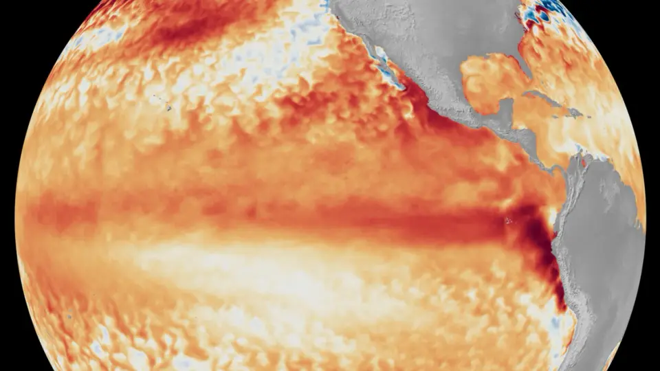
NOAA’s National Weather Service announced that El Niño has formed in the tropical Pacific and is likely to intensify to moderate or strong this fall, with a 63% chance that regional sea surface temperatures exceed 2.0°C—potentially a 'very strong' El Niño. The phenomenon alters the Walker Circulation and typically shifts the winter jet south, bringing warmer northern U.S. winters but drier conditions in parts of the Northwest and Ohio/Tennessee valleys, while the Southern U.S. can see stormier weather; West Coast high-tide flooding and ecological impacts can also occur. NOAA notes that ENSO forecasts now rely on both the ONI and the newer Relative Oceanic Nino Index (RONI), which better tracks changes in the Walker Circulation.
- El Nino forms, expected to strengthen, say NOAA forecasters National Oceanic and Atmospheric Administration (.gov)
- El Niño is officially here, and it could get historically “super” CNN
- El Niño has begun, scientists say, and could bring record heat BBC
- El Niño has formed. Forecasters expect a global weather powerhouse. USA Today
- NOAA: El Niño is here and could become very strong this winter. What that means for NorCal KCRA
Want the full story? Read the original reporting
Read on National Oceanic and Atmospheric Administration (.gov)