
New Data Debunks Myths About Roman Roads: Not All Lead to Rome, Nor Are They Straight
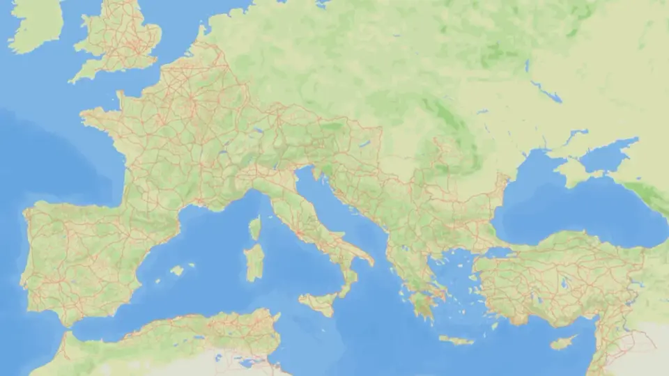
A new study analyzing 300,000 km of Roman roads reveals that the network was more distributed than previously thought, with provincial capitals serving as key hubs rather than Rome. The research also shows that Roman roads were straighter only where terrain allowed, and their continuity into the modern era is less direct than assumed.
Key points
- Researchers created 'itiner-e,' a map of 299,171 km of Roman roads, the largest dataset to date.
- The study found that provincial capitals, not Rome, were the primary hubs for overland communication.
- Roman roads were straight in lowland areas but curved in mountainous regions, unlike modern roads which are straighter due to technology.
- Only about 90% of Roman roads had slopes suitable for wheeled carts, showing engineering constraints.
- The correlation between ancient and modern road networks is weaker than previously believed, with many Roman routes disappearing or changing.
Background
In 2025, archaeologist Tom Brughmans and his team released 'itiner-e,' a comprehensive digital map of the Roman road system. This new study, published in Nature Communications, builds on that dataset to quantitatively analyze the structure and persistence of these roads across the empire.
How outlets are covering it
Gizmodo and New Scientist emphasize the debunking of long-held myths, such as the idea that all roads lead to Rome and that Roman roads are exceptionally straight. Live Science highlights the finding that other cities, particularly provincial capitals, were better connected than Rome. The Nature article provides the technical details, noting that while Roman roads were straighter than modern roads in some areas, they were generally less straight due to topographical constraints. All sources agree that the dataset is not complete, with Brughmans calling it the 'tip of the iceberg.'
Why it matters
This research challenges centuries-old assumptions about Roman infrastructure and provides a more accurate understanding of how the empire was connected. It also highlights the limitations of previous qualitative studies and the importance of quantitative analysis in historical research.
What to watch
The researchers plan to further analyze the dataset to understand how local landscapes affected road courses and how the roads changed over the past 2,000 years. They also aim to explore the multi-scalar nature of the results, which show how continental-scale patterns emerge from local histories.
- Scientists Studied 185,896 Miles of Roman Roads—and That’s Still the ‘Tip of the Iceberg’ Gizmodo
- Study shows marvels of the Roman Empire's road network Reuters
- Roman roads weren’t so straight after all New Scientist
- Network science reveals the structure and lasting impact of the Roman road system Nature
- Did 'all roads lead to Rome'? New study finds other cities in the empire were better connected. Live Science
Want the full story? Read the original reporting
Read on Gizmodo