
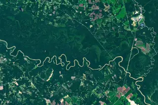
Satellite imagery reveals the dynamic floodplain ecology of Congaree National Park
NASA’s Earth Observatory highlights Congaree National Park in South Carolina, where 80% of the park lies within the Congaree River floodplain. Satellite data from Landsat 9 shows how the river’s meandering path creates distinct ecosystems, including oxbow lakes and nutrient-rich wetlands that support some of the largest old-growth bottomland hardwood forests in the U.S.