Tag

Landsat 9

All articles tagged with #landsat 9

Landsat View Unveils Congaree’s Ancient Floodplain Giants
science7 days ago

Landsat View Unveils Congaree’s Ancient Floodplain Giants

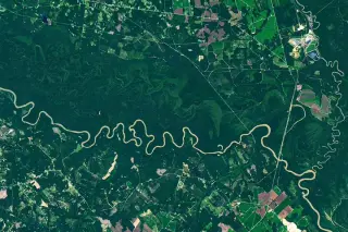
NASA’s Earth Observatory uses a Landsat 9 image to show the Congaree River winding through Congaree National Park’s floodplain forests—one of the largest intact tracts of old-growth bottomland hardwood forests in the United States. The meandering river creates paleochannels, oxbow lakes (like Weston Lake and Bates Old River), and sloughs, with floods depositing nutrient-rich silt that sustains unusually large trees. The park, spared from widespread logging, was designated a national monument in 1976 and became a national park in 2003.

Bare Ice Arrives Early on Barnes Ice Cap, 2026 Melt Quickens
earth-science1 month ago

Bare Ice Arrives Early on Barnes Ice Cap, 2026 Melt Quickens

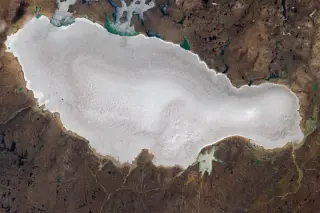
Landsat 9 imagery shows Barnes Ice Cap on Baffin Island losing its snow cover unusually early in the 2026 Arctic summer, exposing bare ice dotted with blue meltwater ponds and a widening network of meltwater channels. With snow gone, the ice warms and melts faster, indicating continued thinning and retreat (historically about 4 m per year over 40 years, with some areas retreating much faster) and earlier surface runoff that reduces refreezing.

NASA Investigates Mysterious Tracks in Greenland's Tunulliarfik Fjord.
science3 years ago

NASA Investigates Mysterious Tracks in Greenland's Tunulliarfik Fjord.

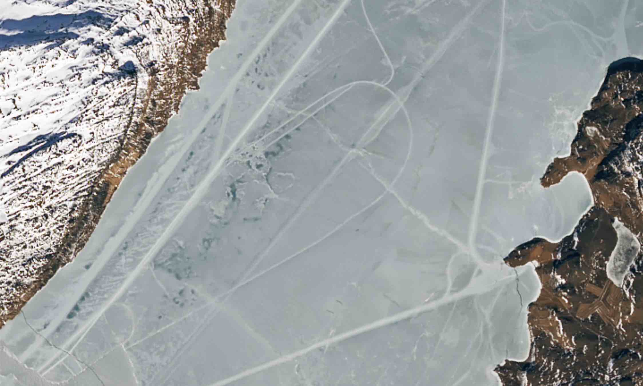
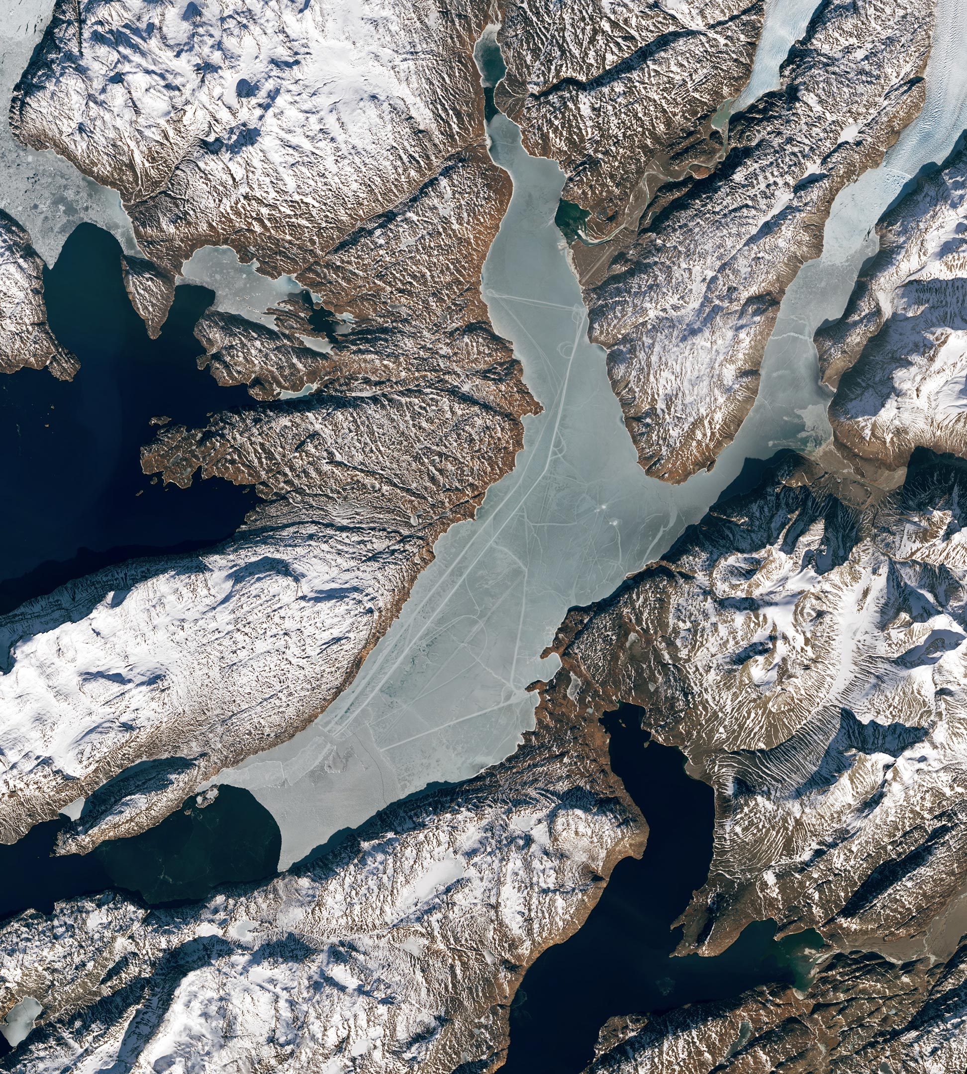
Landsat 9 satellite imagery detected mysterious tracks scoring the icy surface of a remote fjord in Greenland, prompting an investigation by scientists with NASA’s Cryospheric Science Laboratory. While some of the lines seen in the imagery look like natural ice deformation features, others were perfectly geometrical and likely caused by vehicles moving across the surface of the ice. The tracks appeared to originate from the towns of Qassiarsuk and Narsarsuaq, suggesting that residents were out on the ice, possibly hunting or traveling.

NASA Investigates Mysterious Tracks in Greenland's Tunulliarfik Fjord.
science-and-technology3 years ago

NASA Investigates Mysterious Tracks in Greenland's Tunulliarfik Fjord.

NASA scientists have discovered long, straight lines on southern Greenland's Tunulliarfik Fjord, likely created by people using vehicles such as snowmobiles for travel or hunting. The fjord's waters were capped with a layer of sea ice when the images were captured by Landsat 9's Operational Land Imager-2 (OLI-2) on March 13, 2023. The track that runs the length of the fjord is at least 20 kilometers (12 miles) long.

science-and-technology3 years ago

Mysterious Tracks Found in Greenland's Tunulliarfik Fjord

NASA's Landsat 9 satellite captured images of Tunulliarfik Fjord in Greenland, revealing several long, straight lines connecting the towns of Narsarsuaq and Qassiarsuk, and running the length of the fjord. Many of the tracks were likely produced by vehicles, such as snowmobiles, according to scientists at NASA's Goddard Space Flight Center. The track that runs the length of the fjord is at least 20 kilometers long. The fjord's waters are ice-free much of the year, except for floating icebergs that have broken off from the glacier to the north.