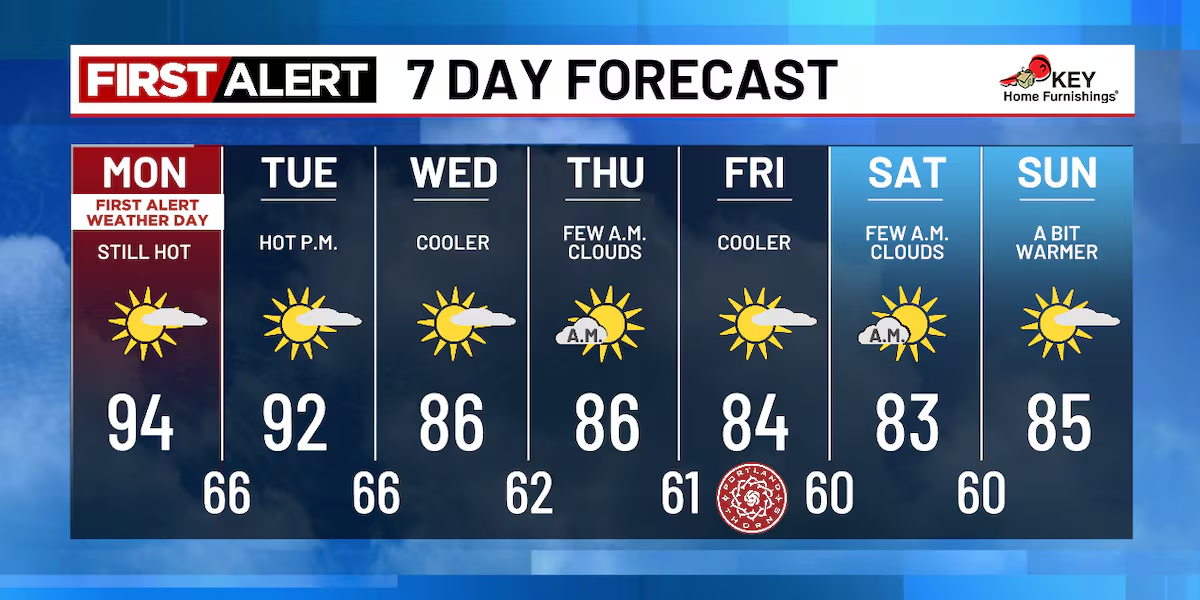
The Northwest is experiencing its fourth consecutive day of extreme heat, with high temperatures in the 90s and 100s, but relief is expected later in the week as a low-pressure system from the Gulf of Alaska brings cooler temperatures and increased humidity.
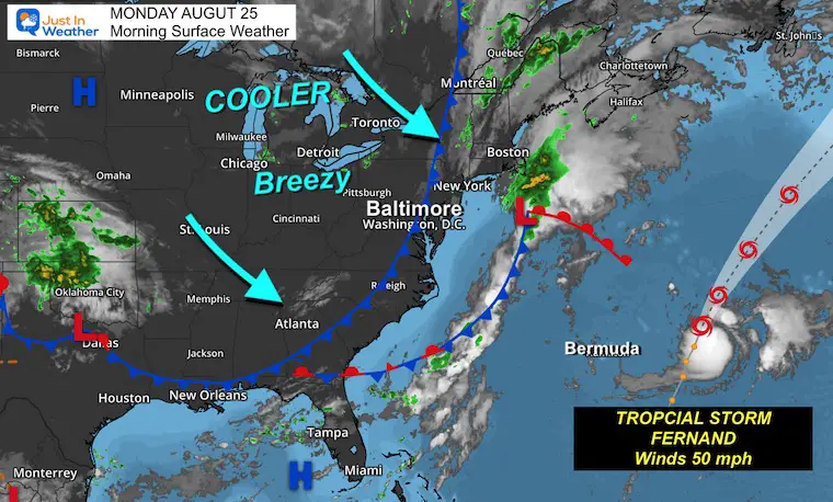
A cold front has moved through, bringing cooler, less humid air and gusty northwest winds, while Tropical Storm Fernand remains offshore and poses no land threat. The week will be dominated by this cooler pattern, with a potential rocket launch visible tonight under clear skies, and temperatures around 10 degrees below average.
A couple of showers are expected tonight in the DC area, with Hurricane Erin passing offshore bringing breezy conditions tomorrow. The weather will improve Friday and Saturday with sunshine and low humidity, but chances of showers and storms return Sunday. A significant cooldown with below-normal temperatures and low humidity is forecast for the upcoming weeks, influenced by high pressure systems over Canada and Greenland. Coastal areas from Virginia to New Jersey will experience dangerous surf, rip currents, and coastal flooding due to Hurricane Erin, which, despite being offshore, poses a serious threat to the East Coast.
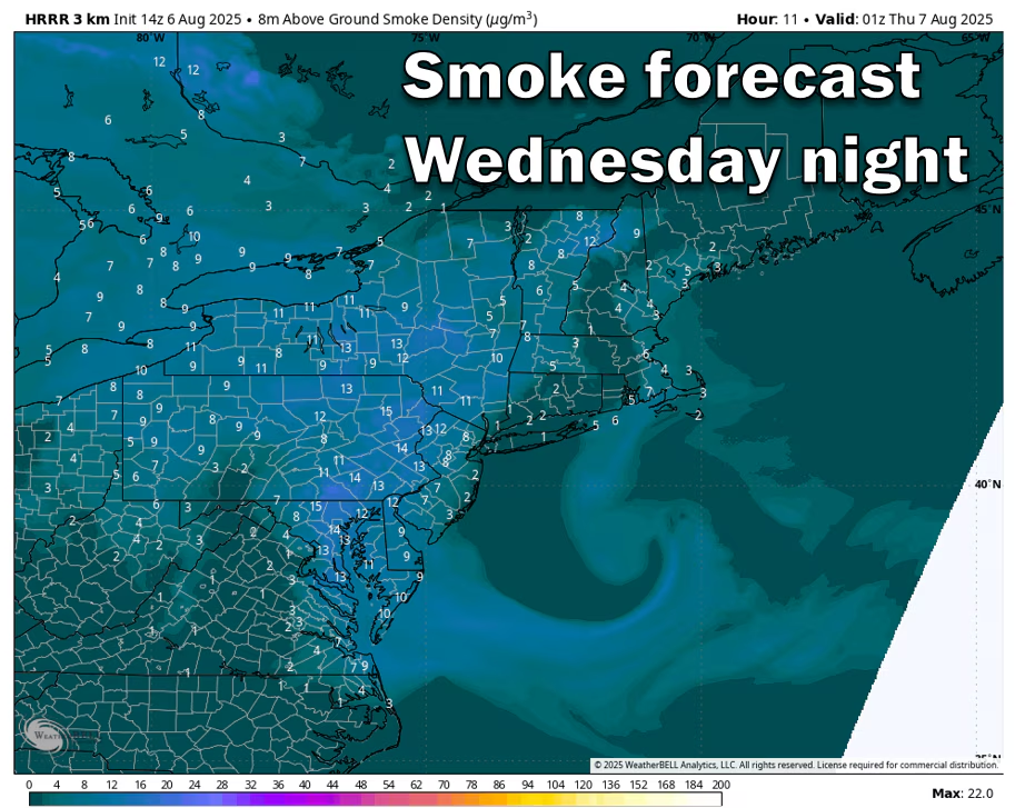
A thin layer of smoke from Canadian wildfires is affecting the D.C. area's air quality and temperatures, causing moderate pollution levels and cooler weather, with conditions expected to improve by Friday.
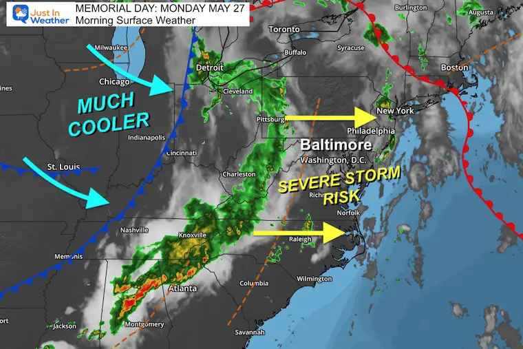
Severe storms are expected to hit the region on Memorial Day afternoon and evening, with potential for flash flooding, high winds, hail, and isolated tornadoes. The weather will turn cooler for the rest of the week, with daily showers possible.
The D.C.-area forecast predicts cooler temperatures with occasional sunshine and passing showers this afternoon. The weekend will see clearing skies and breezy conditions, with temperatures reaching the upper 60s to low 70s. Rain chances are limited, with the possibility of showers overnight and cooler temperatures on Sunday. Mainly bright skies are expected for Monday and Tuesday with high temperatures in the mid-60s to low 70s.
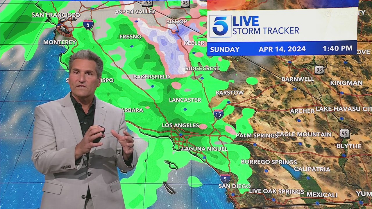
Southern California is set to experience a shift in weather with cooler temperatures and rain as a low-pressure system moves through the region this weekend, bringing a drop in daytime highs by about 10 degrees on Friday and scattered rain showers on Saturday, with coastal areas and valleys expecting less than an inch of rain and mountains and foothills possibly seeing up to 2 inches. Snow levels are expected to drop to around 4,500 feet, with one to four inches of snow forecast at lower elevations and 4-8 inches on higher peaks. Clear skies and warmer temperatures are expected to return early next week.
Today saw springlike temperatures near 50 degrees in Washington D.C., with a possibility of a gusty shower this evening, potentially mixed with snow. Tomorrow will be somewhat cooler with temperatures in the upper 40s, and snow is expected to arrive in the evening and last through the night. The average snow accumulation for the winter season in Washington is 70 percent complete, with March being a fickle month for snowfall.
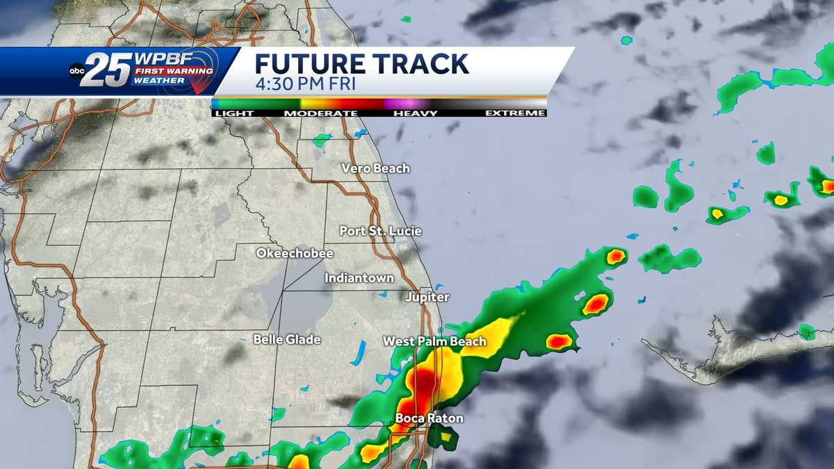
A strong cold front is expected to bring cooler temperatures and scattered showers and storms to South Florida, prompting meteorologists to declare Friday, Saturday, and Sunday as Impact Weather Days. The front will lead to dropping temperatures, with lows in the 40s and 50s and highs in the 60s over the weekend. Severe storms and an EF-0 tornado were confirmed in the region last weekend, and residents are advised to stay updated on the weather through the WPBF 25 News app.
A non-tropical surface low is moving away from Central Florida, leading to weakening winds and decreasing rain chances. Hazards such as high surf, coastal flooding, and rip currents remain at area beaches. The weekend will be dry with seasonable temperatures. However, a strong cold front is expected to approach the area by Wednesday, bringing cooler air and minimal rain chances ahead of Thanksgiving.
North Georgia is expected to experience a change in weather with light rain and cooler temperatures moving in by Wednesday morning, causing wet roads for the morning commute. The rain will clear out by late morning and early afternoon, but temperatures will remain cooler with highs in the mid-50s. The rain is expected to persist through the end of the workweek.
The D.C.-area can expect cooler temperatures today with partial sunshine, followed by a gradual warming trend through midweek. Tomorrow will be mostly sunny with temperatures in the mid- to upper 50s. Dry weather will persist with no rain expected until at least Friday.
The D.C.-area can expect much cooler temperatures today with periods of light rain, followed by clearing skies and calming winds tonight. Tomorrow will be mainly sunny with a slight breeze, while Sunday will be partly sunny and cooler. The week ahead will bring bright and sunny skies with moderating temperatures in the 50s, along with a chance of slightly higher breeziness.
The D.C.-area will experience cooler temperatures today with mostly sunny skies and highs in the upper 50s to low 60s. Tomorrow, temperatures will rise to near-record warmth, reaching the 70s to near 80 with a chance of a light shower in the afternoon. Rain is unlikely to alleviate the expanding drought situation, with only a few showers expected late Thursday and Friday. The weekend will be cooler with highs in the 50s, mostly sunny skies, and a chance of scattered light showers on Friday.
The D.C.-area can expect warmer than average temperatures through Thursday, with a slight chance of rain. However, cooler temperatures are expected over the weekend, with a risk of freezing conditions in the north and west suburbs.