
NASA Maps Carbon Emissions and Tree Coverage in Africa and Worldwide
TL;DR
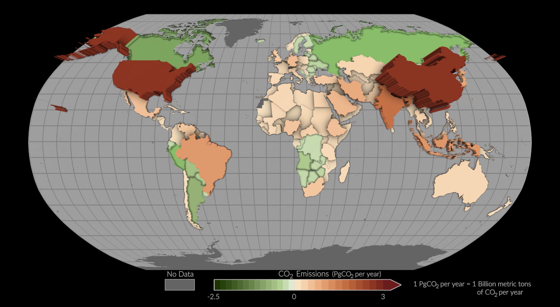
A pilot project using NASA's Orbiting Carbon Observatory-2 (OCO-2) mission has estimated carbon dioxide emissions and removals for more than 100 countries around the world. The study, published in Earth System Science Data, used a measurement-based approach to infer the balance of how much carbon dioxide was emitted and removed. The findings offer a new perspective on carbon dioxide emissions and removals, particularly for nations that lack traditional resources for inventory development. The study provides a new perspective by tracking both fossil fuel emissions and the total carbon “stock” changes in ecosystems, including trees, shrubs, and soils.
Topics:scienceenvironment#carbon-dioxide-emissions#climate-change#environment#nasa#paris-agreement#satellite-measurements
- NASA Space Mission Reveals Carbon Dioxide Emissions for Countries Around the World SciTechDaily
- Carbon dioxide emissions by country: See the map EarthSky
- NASA Satellite Measures CO2 Emissions of Over 100 Countries from Space | Weather.com The Weather Channel
- NASA Scientists Map 10 Billion Individual Trees in Africa's Drylands To Estimate Carbon Stored SciTechDaily
- View Full Coverage on Google News
Want the full story? Read the original reporting
Read on SciTechDaily