
NASA Pilots Fly Into Wildfire-Generated Storms to Map Dangerous Weather Patterns
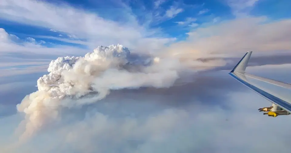
A NASA-led research mission is actively flying aircraft into pyrocumulonimbus clouds, the intense thunderstorms generated by large wildfires, to better understand how these fires create their own severe weather. The project, which began in the summer of 2026, involves pilots like Bo LeMay flying Gulfstream V planes directly into these hazardous conditions. This initiative aims to gather data on the unique atmospheric dynamics of fire-driven storms, which are increasingly relevant as wildfire seasons become more intense and unpredictable. By studying these 'fire clouds' from the inside, researchers hope to improve forecasting models and understand the feedback loop between fire intensity and local weather patterns.
Key points
- NASA launched a summer 2026 mission to study pyrocumulonimbus clouds, which are massive thunderstorms formed by the heat and smoke of large wildfires.
- Pilot Bo LeMay flew a Gulfstream V research aircraft directly into these dangerous clouds, a maneuver typically avoided by commercial pilots due to extreme turbulence and hazards.
- The mission focuses on understanding how wildfires generate their own weather systems, a phenomenon that complicates firefighting efforts and evacuation planning.
- Data collected from these flights aims to improve the accuracy of weather forecasts in wildfire-prone areas, potentially aiding in early warning systems for communities at risk.
Background
This research follows a series of significant wildfire events in 2025 and 2026, including the catastrophic Los Angeles fires that killed 31 people and the massive Ross Fire in North Texas that burned 90,000 acres. Recent reports have highlighted failures in evacuation alerts and coordination during these events, emphasizing the need for better predictive tools. Additionally, the Hawk Fire near Lake Tahoe demonstrated how rapidly wildfires can spread under dry, windy conditions, underscoring the urgency of understanding the atmospheric factors that drive such events.
Why it matters
Understanding the weather systems created by wildfires is critical for improving safety and response strategies. As climate change potentially extends and intensifies fire seasons, the ability to predict how a fire will influence local weather could save lives and reduce property damage. This NASA project represents a shift toward proactive, data-driven approaches in managing wildfire risks, moving beyond reactive firefighting to include atmospheric science in disaster preparedness.
What to watch
The primary next step is the analysis of the data collected from the summer flights to refine weather models. Researchers will likely publish findings that could influence future firefighting protocols and public safety guidelines. Additionally, this data may inform policy discussions on building standards and land-use planning in wildland-urban interfaces, as seen in areas like Reno, where population growth has increased exposure to fire risks.
Want the full story? Read the original reporting
Read on NBC News