
French Navy Drone Uncovers 16th-Century Wreck at Record Depth
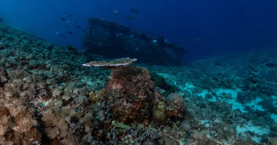
A routine seabed mapping mission by a French Navy drone in March 2025 accidentally discovered a 16th-century merchant ship at 2,567 meters, setting a new record for the deepest wreck in French waters. The vessel, named Camarat 4, lies off Saint-Tropez and remains largely intact due to its extreme depth, which prevented historical looting. Initial surveys revealed a 30-meter hull with approximately 200 ceramic jugs, 100 plates, and six cannons, suggesting an origin in Liguria, Italy. Authorities plan a two-year digital reconstruction rather than immediate salvage, highlighting how modern resource-mapping technology is now uncovering hidden maritime history in previously inaccessible deep waters.
Key points
- Discovery occurred in March 2025 during a government seabed mapping project near Ramatuelle, south of Saint-Tropez, using a self-guided drone.
- The wreck, designated Camarat 4, rests at 2,567 meters, surpassing the previous record held by the submarine La Minerve, which sank in 1968.
- The ship measures approximately 30 meters long and 7 meters wide, dating from the 1500s, and is described as 'almost intact' by officials.
- Cargo includes roughly 200 ceramic jugs with IHS monograms, 100 yellow plates, two cauldrons, an anchor, and six cannons.
- Archaeologists plan to spend two years creating a 3D digital reconstruction and sampling limited items rather than recovering the entire vessel.
- The discovery underscores that deep-sea mapping drones for resource surveys are now uncovering historical artifacts previously unreachable by divers.
Background
This discovery aligns with broader trends in ocean exploration, where less than 30% of the global ocean floor is mapped to modern standards. While previous archive items noted concerns about foreign components in military drones and celebrity presence in Saint-Tropez, the current event highlights a shift in how deep-sea archaeology is conducted. The reliance on autonomous underwater vehicles for routine government tasks, such as tracking minerals and cables, has inadvertently opened access to historical sites that were previously protected by their depth from human interference and looting.
Why it matters
The finding of Camarat 4 demonstrates that the deep ocean is no longer a sealed archive. As technology advances, routine industrial and military surveys are increasingly likely to encounter historical artifacts. This shifts the responsibility for discovery from specialized archaeological expeditions to broader government and commercial mapping efforts, potentially accelerating the documentation of maritime history while raising questions about the preservation and management of these newly accessible sites.
What to watch
The French underwater archaeology department, DRASSM, will proceed with a two-year project to build a comprehensive 3D digital model of the site. Only minimal physical sampling is planned to preserve the integrity of the wreck. Researchers will analyze the ceramic cargo to confirm the ship's origin in Liguria and its trade routes. Additionally, the success of this accidental discovery may prompt more systematic deep-sea surveys in the Mediterranean to identify other hidden wrecks in unmapped areas.
Want the full story? Read the original reporting
Read on Space Daily