
Satellite data reveals ongoing Gaza destruction despite ceasefire
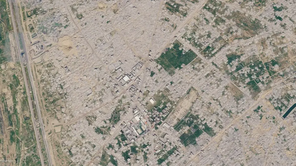
New satellite imagery confirms that significant destruction in Gaza continues despite a ceasefire, with 82% of structures damaged and 74,000 people killed since the war began in 2023.
Key points
- Google Maps updated satellite imagery in June 2026, showing widespread destruction in Rafah and other areas, but the images were not new as they were available since June 2026.
- Planet Labs satellite imagery from September 2026 shows further destruction in Rafah and northern Gaza, including the demolition of buildings near the municipal stadium and schools in the Tal as Sultan area.
- The UN reports that 82% of structures in Gaza, roughly 200,000 buildings, have been damaged, with two-thirds destroyed, and the number of destroyed structures has increased by 9% since the ceasefire began in October 2025.
- Over 74,000 Palestinians have been killed since the war began in October 2023, with more than 1,400 killed and 5,000 injured since the ceasefire took effect.
- The destruction has affected key sites such as the port of Gaza City, the Jabalia refugee camp, and the Istiqlal mosque in Khan Younis, with farmland and infrastructure severely damaged.
Background
This story follows earlier coverage of satellite imagery revealing the scale of destruction in Gaza, including a 9% increase in destroyed structures since the ceasefire began in October 2025. The conflict, which started in October 2023, has led to widespread displacement and humanitarian crises, with 2.3 million inhabitants affected.
How outlets are covering it
Bellingcat and Planet Labs emphasize the ongoing destruction despite the ceasefire, with Planet Labs providing the most recent imagery from September 2026. The Guardian and Al Jazeera highlight the humanitarian crisis and the scale of destruction, with Al Jazeera noting the 9% increase in destroyed structures since the ceasefire. El País focuses on the visual evidence of destruction in key areas such as Tel al-Sultan and Gaza City.
Why it matters
The ongoing destruction in Gaza, despite a ceasefire, highlights the continued humanitarian crisis and the need for international attention and action. The satellite imagery provides crucial evidence of the scale of destruction, which is essential for understanding the impact of the conflict on the population and infrastructure.
What to watch
Further satellite imagery may reveal additional destruction in Gaza, and international organizations may continue to assess the humanitarian situation. The UN and other bodies may call for increased aid and support for the displaced population.
- Viral Google Maps Images Shared Widely This Week Show Gaza Ruins. We Obtained More Recent Satellite Imagery Bellingcat
- New Google Maps images reveal massive scale of devastation in Gaza The Guardian
- Satellite images show Gaza in ruins three years into Israel’s genocidal war Al Jazeera
- Gaza before and after: New Google Maps imagery shows destruction of the Strip EL PAÍS English
- Satellite Images Show Scale of Gaza Devastation After Years of Israeli Strikes Haaretz
Want the full story? Read the original reporting
Read on Bellingcat