Ukraine’s drones tighten the net on Crimea’s supply lines with precise bridge strikes
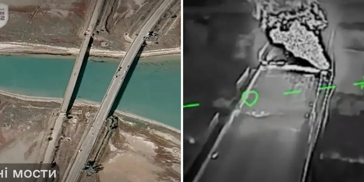
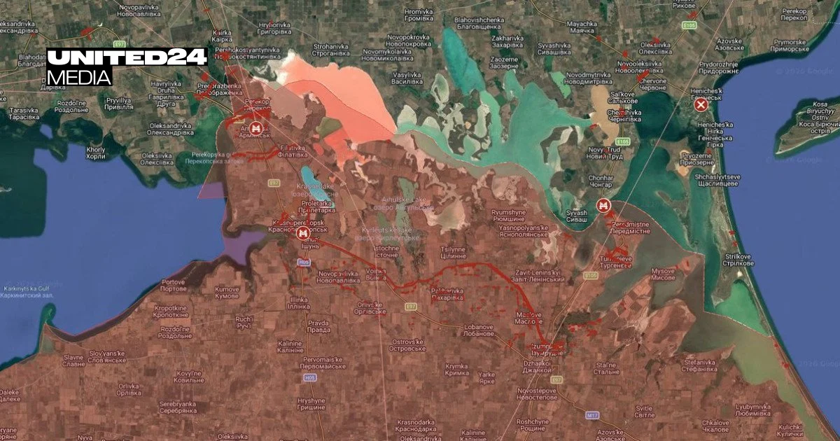
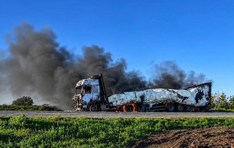
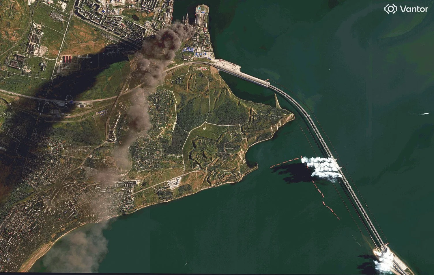
Ukraine’s expanding medium‑range drone campaign is delivering increasingly precise blows to Russian supply lines on the Crimea isthmus, repeatedly striking road and railway bridges including the Rozdolne north‑Crimean Canal crossing and disrupting repairs as Sevastopol experiences outages. The effort, tracked by OSINT channels, is shaping debate on whether Ukraine will target the Crimean Bridge itself while Russia reinforces with pontoon crossings and embankments. The report also covers related strikes on Voronezh and Bryansk targets with Storm Shadow/SCALP‑EG missiles and tallies of equipment losses on both sides, according to Oryx data.