
West Coast storm signals broader El Niño-driven weather shift
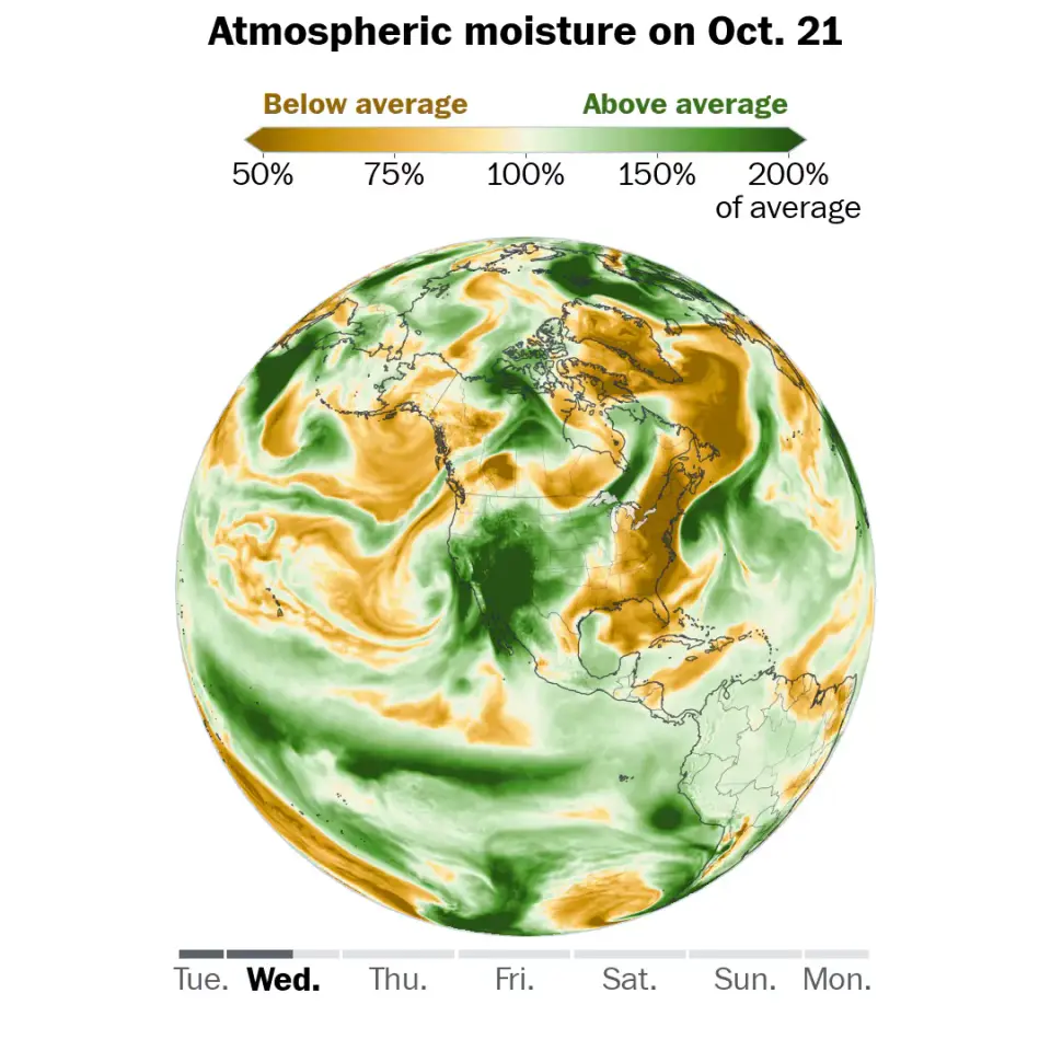
A slow-moving storm system is bringing significant rainfall and severe thunderstorm risks to the West Coast and Southwest this week. Forecasters warn this event is likely the first of a more active pattern driven by a record El Niño, which is strengthening upper-level winds and increasing the likelihood of frequent storms through November.
Key points
- Flood watches are active for parts of Southern California, Arizona, Utah, Colorado, and New Mexico as the system lingers through the weekend.
- The National Weather Service describes the severe storm risk in the interior Southwest as 'climatologically rare' and 'well-above-typical,' with a Level 3 risk for severe weather in the Phoenix-Flagstaff corridor.
- Record warm ocean temperatures near California are adding moisture to the storms, while a record El Niño is fueling a strong subtropical jet stream pattern.
- The Los Angeles Times notes a 30% to 40% chance of thunderstorms and minor flooding in Los Angeles and Ventura counties, with the Santa Monica Mountains identified as the highest risk area.
- The Los Angeles Daily News reports that rainfall totals in Los Angeles County are expected to average 1.5 inches, with up to 3 inches possible in terrain-enhanced areas.
Background
This weather event follows a series of recent storms, including Tropical Storm Simon and Hurricane Trudy, which impacted the Pacific coast in early October. A separate Pacific storm also brought heavy rain to the Southwest on October 20. The current conditions are part of a broader trend of increased storm activity linked to a record El Niño, which has been driving a record-breaking hurricane season in the eastern Pacific.
How outlets are covering it
The Washington Post emphasizes the broader climatic implications, linking the current storm to a record El Niño and a strengthening subtropical jet stream that will likely fuel increasingly stormy weather across the United States in November. The Los Angeles Times focuses on localized impacts, highlighting specific rainfall probabilities and flood risks in the Santa Monica Mountains and recent wildfire burn scars. The Los Angeles Daily News provides detailed local forecasts for Los Angeles and Orange counties, noting the potential for debris flows and the subsequent return of dry weather and Santa Ana winds by the weekend.
Why it matters
The convergence of a record El Niño, warming oceans, and a strengthening jet stream suggests a shift toward a more volatile weather pattern. This could lead to increased frequency and intensity of storms, flooding, and severe weather events across the West Coast and Southwest in the coming months, posing significant risks to infrastructure, public safety, and recent wildfire burn areas.
What to watch
The storm is expected to linger over the West through the weekend, with dry weather returning on Friday. However, forecasters anticipate another round of offshore Santa Ana winds over the weekend, followed by a rebound in temperatures. The broader El Niño-driven pattern is expected to continue fueling stormy weather across the United States through November.
- Why a West Coast storm may be the start of something much bigger The Washington Post
- Flood watch issued as Pacific storm reaches Southern California KTLA
- Flood threat from California to Colorado, severe storms target Arizona The Weather Channel
- Storms descend on Southern California, raising risk of dangerous surf, flooding, debris flows Los Angeles Times
- Rain — and potentially lots of it — heading to Southern California Los Angeles Daily News
Want the full story? Read the original reporting
Read on The Washington Post