
Super Typhoon Champi Overtakes Polo as 2026’s Most Powerful Cyclone
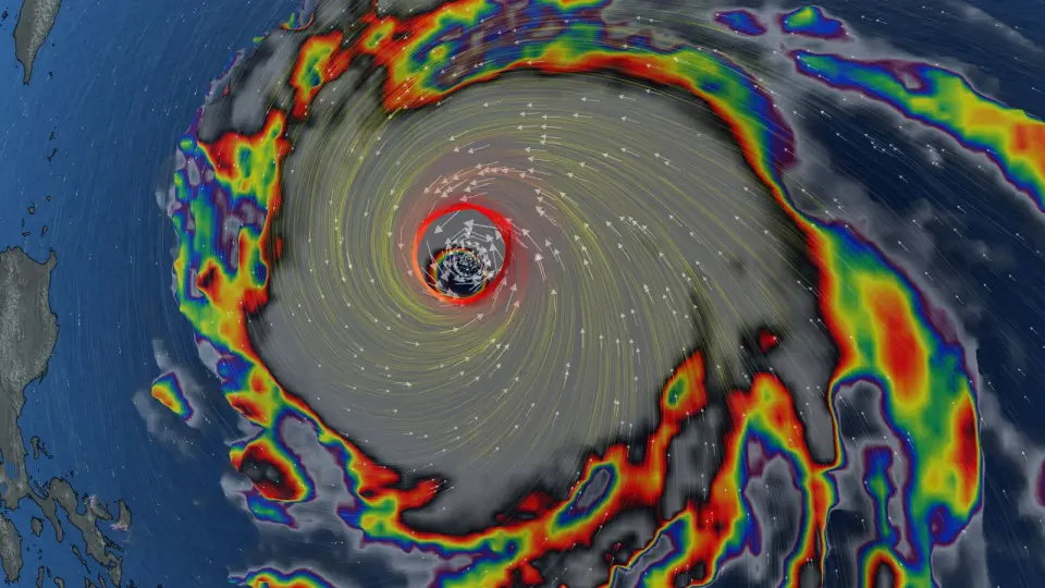
Super Typhoon Champi has become the strongest tropical cyclone of 2026 by wind speed, reaching 296 km/h. It is now the seventh Category 5 storm of the year. The storm is tracking west toward Taiwan, where a sea warning is expected, while its influence is already altering weather patterns in Canada.
Key points
- Champi peaked at 296 km/h, surpassing Hurricane Polo’s 285 km/h to become the fastest storm of 2026.
- Champi’s central pressure is 895 mb, slightly higher than Polo’s 892 mb, but its wind speed is greater.
- The storm passed Guam early Sunday and is now moving west-northwest at 23 km/h toward Taiwan.
- Taiwan’s Central Weather Administration expects a sea warning tonight and possible land warnings for northern regions tomorrow night.
- Champi is forecast to weaken to Category 3 or 4 by Thursday and Friday as it enters cooler waters.
- The storm is influencing the jet stream, leading to unsettled and warmer-than-normal weather in Ontario and Quebec.
Background
Champi has intensified rapidly since mid-October, fueled by sea surface temperatures near 30°C, which are slightly warmer than normal due to a strong El Niño. It previously threatened Guam and was expected to rival other major storms of the season. Hurricane Polo, which previously held the title for the strongest storm of 2026, was the second-most intense hurricane on record in the eastern Pacific.
How outlets are covering it
The Weather Network emphasizes Champi’s global ranking and its downstream impact on Canadian weather, noting that the storm is tugging on the jet stream. Surfline focuses on the storm’s trajectory toward Taiwan and its potential to weaken as it approaches cooler waters. The Taipei Times provides local details, highlighting that while some international models predict a close approach to Taiwan, the probability of the storm veering northeast has increased. The CWA notes that the interaction between the typhoon and the northeast monsoon will likely occur over the ocean, not directly over Taiwan, but heavy rainfall is still expected nationwide on Friday.
Why it matters
Champi’s intensity sets a new benchmark for the 2026 storm season, highlighting the impact of El Niño on tropical cyclone strength. Its path toward Taiwan poses immediate risks of heavy rain, strong winds, and large waves, while its influence on the jet stream is already affecting weather patterns in North America, including Canada.
What to watch
Champi is expected to turn north tomorrow, with its exact path determining its proximity to Taiwan. It will likely weaken to Category 3 or 4 by Thursday and Friday as it moves into cooler waters. Rain is expected to ease by Saturday afternoon as the storm departs, but the jet stream influence may continue to affect weather in Canada into early November.
- 296 km/h: Super Typhoon Champi is now the strongest storm on Earth in 2026 The Weather Network
- Watch: Insane Satellite Graphics Reveal Super Typhoon Champi’s Giant Eye SURFER Magazine
- Super Typhoon Champi becomes strongest storm on Earth this year as Pacific eyes first V-named storm since 2018 FOX Weather
- Severe Typhoon Champi Takes Aim On Taiwan Surfline
- Sea warning expected for typhoon Taipei Times
Want the full story? Read the original reporting
Read on The Weather Network