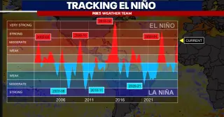
Forecasters say a developing super El Niño could intensify through autumn, bringing a milder, rainier fall and a moisture-rich winter for the Mid-Atlantic, with a boom-or-bust potential for snow and a generally quieter Atlantic hurricane season overall.
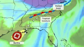
Tropical Storm Bertha is weakening but a broad plume of tropical moisture linked to the system will fuel heavy rain and a multi-day flood threat from the Mid-Atlantic to the Southeast through Thursday and into Friday. The storm’s center is expected to move along the Louisiana and upper Texas coasts before dissipating in Texas, while rain totals in the region reach 2–4 inches (locally 6 inches) along the Texas Gulf Coast; further east, rainfall could be heavy enough to cause flash and urban flooding, with some areas facing a potential month’s worth of rain in a few days. Forecasters have placed a Level 3 of 4 flood risk on parts of the Virginia–North Carolina border Thursday into Friday, and Level 2 of 4 from coastal North Carolina through South Carolina and into northern Georgia and northeast Alabama on Friday, with upgrades possible as forecasts firm up. This flood threat compounds ongoing rainfall concerns from a separate West Virginia flooding event earlier in the week.
A storm system will threaten more than 40 million people across the Mid-Atlantic and Carolinas this weekend, bringing damaging winds and potential flash flooding; Saturday brought heavy rain, 70 mph gusts, and about 240,000 power outages, with a Flash Flood Warning issued for all NYC boroughs. Gov. Mikie Sherrill urged travelers to plan ahead as the system moves south Sunday, with a Level 2 out of 5 severe-threat expanding to eastern North Carolina and Virginia and rainfall possibly reaching 1–3 inches in spots, with the pattern expected to continue into Monday.
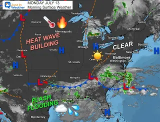
A mid-Atlantic heat wave builds midweek with humid conditions and highs near 100°F, then a storm track brings strong thunderstorms by the weekend. The 7‑day forecast shows Monday 86°F, Tuesday 93°F, Wednesday around 100°F, Thursday ~99°F, Friday ~97°F, Saturday ~96°F, and Sunday ~92°F, with a potential tropical low developing in the Gulf later in the week.
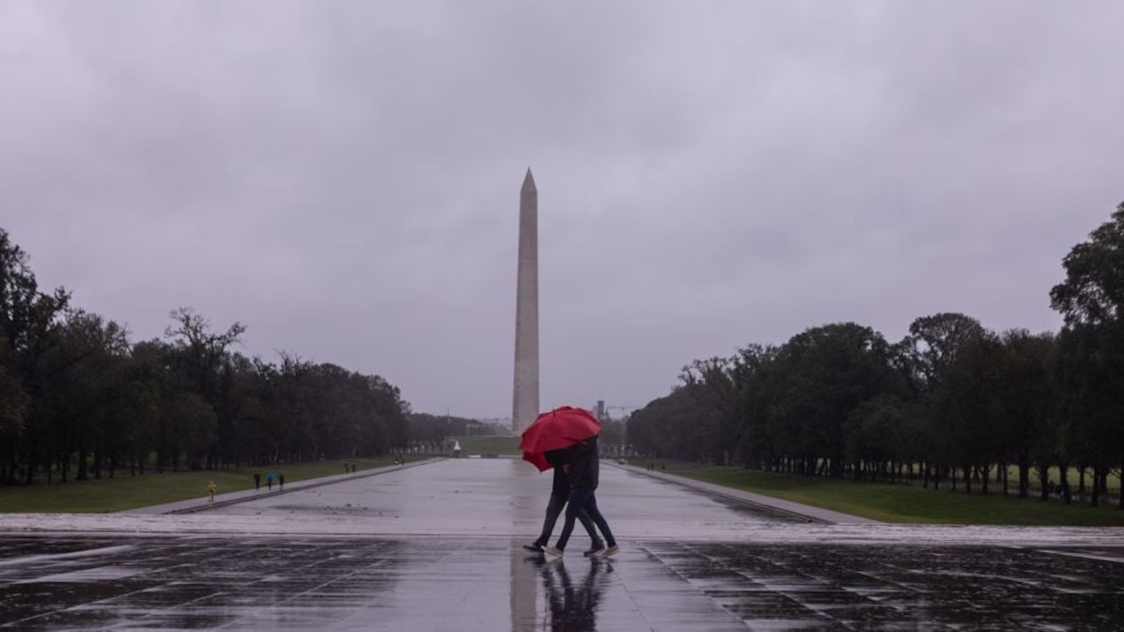
Thunderstorms swept the eastern U.S., triggering tornado advisories, mass flight cancellations and widespread power outages as forecasters warned of hurricane-force winds in the Mid-Atlantic. With 94 million people under alerts, the worst impacts were expected in the afternoon and evening, prompting North Carolina to activate its emergency team and Washington, D.C., officials to urge shelter and close landmarks. The storm system also brought travel disruptions from the Southeast to the Midwest, along with related risks of flash flooding, seasonal blizzards in the Great Lakes, and dramatic temperature swings.
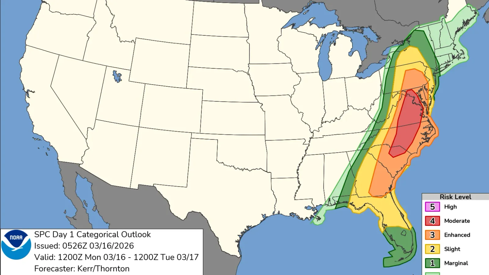
A Level 4 out of 5 severe-weather risk stretches from Maryland to South Carolina, with the Mid-Atlantic and Carolinas facing damaging winds, hail, and a few strong tornadoes—centered on the D.C. area—as forecasters warn of a significant outbreak on Monday.
A line of severe thunderstorms is moving from the South through the Ohio Valley into the mid-Atlantic, spawning tornadoes, giant hail, and damaging winds with hundreds of reports. On Wednesday, additional tornadoes and damaging winds are possible across the South, Midwest and East, along with 1–3 inches of rain that could trigger flash flooding; multiple watches are in effect and safety guidance is being shared. Yesterday’s outbreaks included EF1 tornadoes in Illinois and Indiana and large hail across several states.
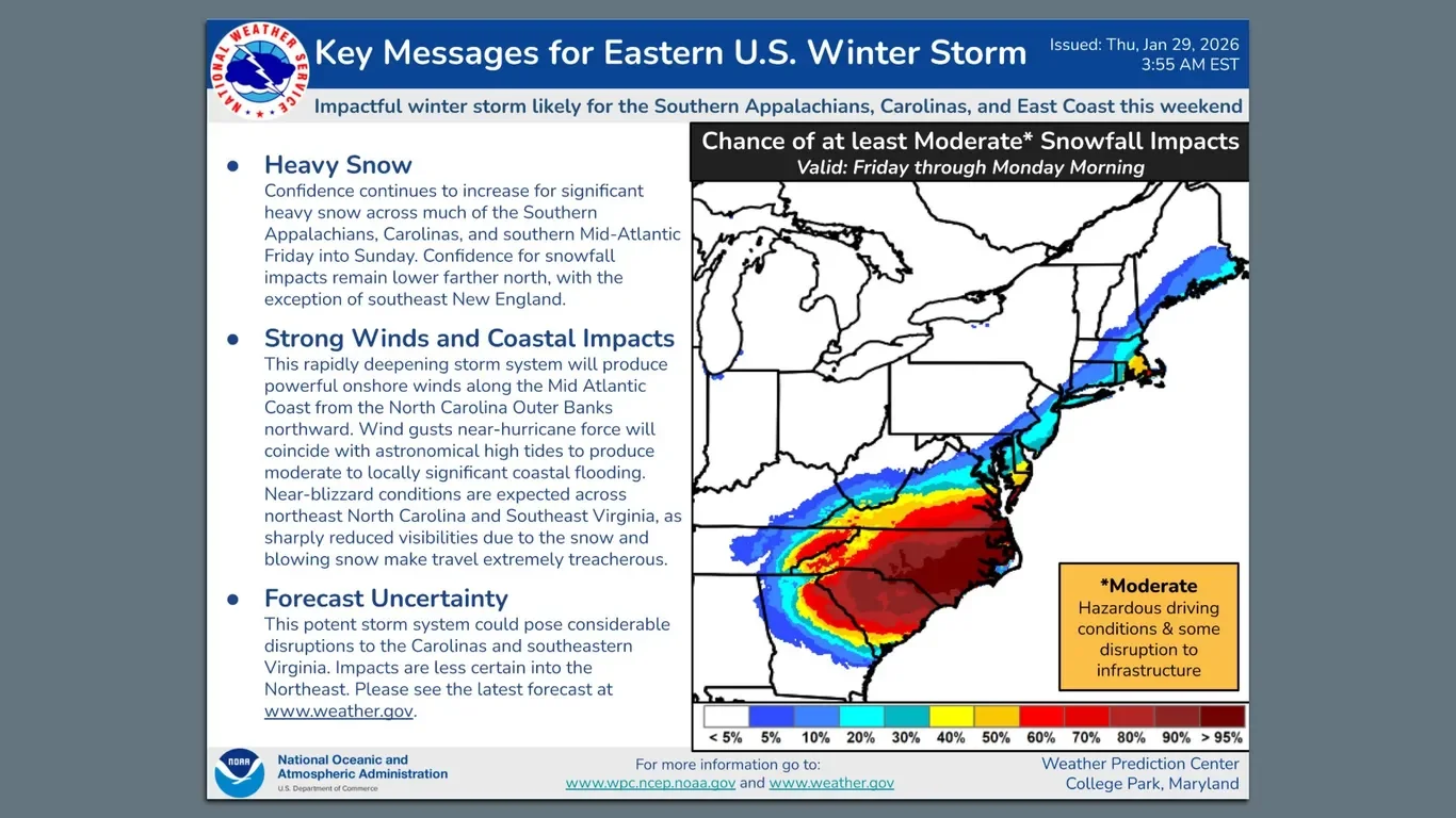
A rapidly deepening winter storm threatens the Southeast to Northeast this weekend, delivering heavy snow inland and along the North Carolina coast, plus onshore winds with near-hurricane gusts and coastal flooding. About 22.5 million people are under winter-storm watches; Raleigh could see around 8 inches, Richmond 1–8 inches, and impacts could affect major cities like Washington, Philadelphia, New York, and Boston, though forecast totals vary widely and may shift as the storm tracks near or off the coast.
Airlines including American, Southwest, Delta, United, and JetBlue are waiving flight-change fees and fare differences for flights in the mid-Atlantic and Northeast U.S. ahead of a major coastal storm, with minimal delays or cancellations reported.
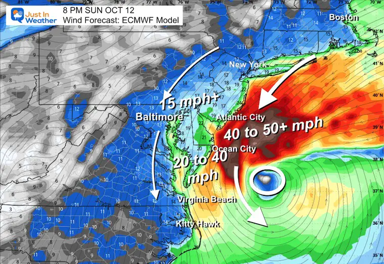
A rare coastal storm is developing with a looping track over the Mid-Atlantic, making rainfall predictions challenging. The storm involves the interaction of two short waves in the jet stream, potentially stalling or looping for days, with rain expected from Saturday through Tuesday. Multiple weather models show a wide range of possible rainfall totals, emphasizing the uncertainty in exact impacts.
A rocket launch from NASA's Wallops Island in Virginia is scheduled for Tuesday night, weather permitting, and may be visible in the skies of eastern Pennsylvania, New Jersey, and the Mid-Atlantic region, with vapor-tracing clouds enhancing visibility and tracking of atmospheric winds.
Hurricane Erin, a Category 3 storm in the Atlantic, has prompted the closure of beaches in New Jersey and Delaware due to dangerous rip currents, which have already caused at least one death, as the storm affects the East Coast despite moving away from it.
A severe weather system is threatening the Mid-Atlantic and Southeast regions of the US with heavy rainfall, flash floods, damaging winds, and isolated tornadoes, impacting major cities like Washington D.C., Philadelphia, Baltimore, and Richmond, amid ongoing catastrophic flooding in Texas and New Mexico.
Roy Rogers, once a dominant fast food chain in the Northeast and Mid-Atlantic with over 600 locations in the 1990s, is experiencing a resurgence with plans to reopen and expand in areas like South New Jersey and Northern Virginia, after years of decline following its acquisition by Hardee's. The brand is slowly regaining its presence, with around 40 locations now, signaling a hopeful revival for fans of its classic menu.
Researchers warn that babesiosis, a malaria-like disease spread by ticks, is spreading in the mid-Atlantic US due to climate change, and doctors may be unprepared for the rise in cases, highlighting the need for increased awareness and public health measures.