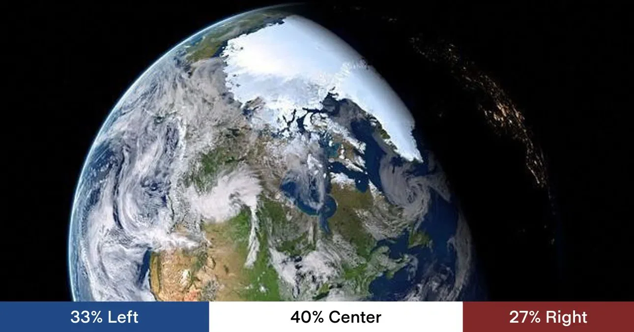
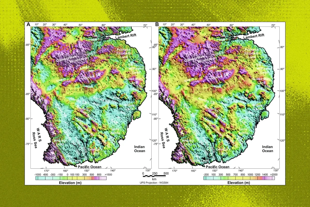
Researchers deployed a 10-km fiber-optic cable to monitor a Greenland glacier and detected massive underwater waves generated by iceberg calving. These internal waves keep warm seawater in contact with the glacier base, creating a calving multiplier that speeds up melt and could amplify ice loss and influence ocean circulation.
A study by researchers from the University of Vienna and ETH Zurich finds Earth’s day is lengthening by about 1.33 milliseconds per century due to climate‑driven mass redistribution from melting polar ice and mountain glaciers, moving water from land to oceans and slowing Earth's rotation. This unprecedented pace in 3.6 million years could subtly affect GPS satellites and space missions over time, though the change is far too small for people to notice; by the end of the century, climate-driven effects could rival the Moon's influence on day length.
New research published in Antarctic Science explains Blood Falls: the red water is iron oxide formed by ancient subterranean bacteria, while the liquid is a hypersaline brine kept unfrozen at -20°C; eruptions occur when pressure builds in subglacial channels beneath Taylor Glacier, forcing brine out in bursts and briefly slowing the glacier, with warming's future effects still unknown.
Scientists link Antarctica’s Blood Falls red plume to a subglacial brine drainage event beneath Taylor Glacier, showing the red water is a signal of pressure changes and hidden water movement under the ice. The discharge temporarily lowered surface ice velocity and disturbed lake stratification, highlighting a tight ice–rock–lake connection and suggesting expanded sensor networks for future study.
Weather delays finally allowed scientists to set up a field camp on Antarctica's fast-melting Thwaites Glacier. Over the coming weeks they will bore about half a mile into the ice to deploy instruments in the warming ocean beneath, seeking to understand how seawater is eroding the glacier and what its collapse could mean for global sea levels. The temporary camp includes ten single-occupancy tents, a science tent and two toilet tents after helicopter landings were previously blocked by clouds.
A Geophysical Research Letters study reports 362 previously unrecognized earthquakes linked mainly to Thwaites Glacier between 2010 and 2023, highlighting heightened fragility and urging a dedicated seismic network to monitor rapid glacial changes and potential global sea-level impacts.
A team of nearly 40 scientists is heading to Antarctica to study the rapidly melting Thwaites Glacier, which poses a significant threat of causing global sea levels to rise by over two feet if it collapses, potentially triggering a catastrophic collapse of the West Antarctic ice sheet. The research involves innovative methods, including attaching sensors to seals to gather ocean data, to better understand the glacier's melting processes and future risks.
Scientists using satellite technology have uncovered a 34-million-year-old landscape beneath Antarctic ice, revealing a lush, river-filled terrain from when Antarctica was part of the supercontinent Gondwana, providing insights into Earth's climate history and future ice sheet stability.
A fisherman in Canada captured a rare black iceberg in the Labrador Sea, which is unusual due to its dark coloration. Such icebergs can be darkened by accumulated dirt, debris, volcanic soot, or remnants of glaciers, and may be very old. The exact cause of this particular iceberg's color remains uncertain, highlighting the mysterious and diverse nature of ice formations in the Arctic and sub-Arctic regions.
Researchers from Washington University in St. Louis have discovered that the Ross Ice Shelf in Antarctica is jolted daily by movements of ice streams, affecting its stability. This previously unnoticed phenomenon, which can trigger icequakes and fractures, highlights potential impacts on global sea levels. The study reveals that these slip events, causing the ice shelf to move several centimeters once or twice a day, have likely gone undetected for over a century. The findings underscore the importance of understanding ice shelf dynamics in the context of climate change.
Research from Washington University in St. Louis reveals that the Ross Ice Shelf in Antarctica, the largest ice shelf on the continent, is being displaced daily by the Whillans Ice Stream. This movement, which can be up to 8 centimeters, is caused by sudden slips in the ice stream and could influence icequakes and fractures, raising concerns about the stability of ice shelves in a warming world. The study highlights the potential impact on sea level rise if the ice shelf were to collapse.
Scientists have discovered that a fracture at the Pine Island Glacier in Antarctica opened at a staggering speed of 80 miles per hour, shedding light on the rapid changes occurring in the region's ice shelves and the potential impact on sea level rise. This finding underscores the urgency of studying glacial dynamics and the need for further research to understand the implications for the stability of the Antarctic ice sheet.
Klinaklini Glacier in British Columbia, Canada, is part of a critical system of glaciers and ice fields that contribute to freshwater resources and influence local climate conditions. Like many glaciers worldwide, it is being closely monitored for changes in response to climate change, with studies showing signs of retreat and reduced ice mass. The glacier plays a crucial role in the local ecosystem by feeding into the Klinaklini River, supporting wildlife and salmon populations. Research on this glacier contributes to understanding glaciology, climate change, and hydrology, providing essential insights into the broader impacts of climate change on glacial systems globally.
Scientists have discovered a vast hidden landscape of hills and valleys, created by ancient rivers, that has been preserved under the Antarctic ice for millions of years. This landscape, larger than Belgium, remained untouched for over 34 million years, but human-driven global warming poses a threat to its exposure. Using satellite images and radio-echo sounding data, researchers were able to trace out the undulating ice surface and reveal a river-carved landscape. The study warns that global warming could lead to the exposure of this hidden world, as atmospheric conditions similar to those of 14 to 34 million years ago are projected. However, the landscape is currently hundreds of kilometers inland from the ice edge, making any possible exposure a long way off.
Scientists have discovered a vast, hidden landscape of hills and valleys carved by ancient rivers under the Antarctic ice, which has remained untouched for potentially more than 34 million years. The landscape, larger than Belgium, was revealed using existing satellite images and radio-echo sounding data. However, human-driven global warming poses a threat to this hidden world, as it could be exposed in the future. The researchers warn that current atmospheric conditions are similar to those that prevailed millions of years ago, and the melting of the ice sheet could lead to a "runaway reaction" of melting.