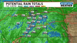
Utah braces for thunderstorms and mountain snow from cold front
A cold front will bring thunderstorms and mountain snow to Utah, with wind advisories in effect statewide as Storm No. 2 approaches; expect windy conditions Sunday ahead of its arrival.

All articles tagged with #mountain snow
A cold front will bring thunderstorms and mountain snow to Utah, with wind advisories in effect statewide as Storm No. 2 approaches; expect windy conditions Sunday ahead of its arrival.
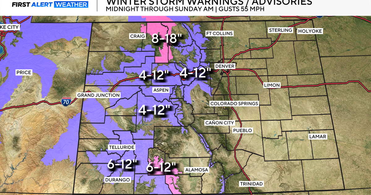
A major weather change is expected in Denver with snow and a significant temperature drop, turning Sunday into a First Alert Weather Day. The mountains will see heavy snow, and the metro area may experience light snow with cold temperatures and icy roads, but temperatures will rebound by mid-week.
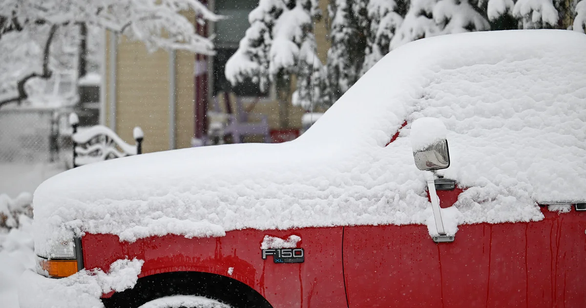
A weather system involving an atmospheric river is bringing accumulating snow to Colorado's high country, with 4 to 8 inches expected and up to 18 inches near Vail Pass, causing travel delays and potential road closures, while the Front Range may see 1 to 5 inches of slushy, melting snow.
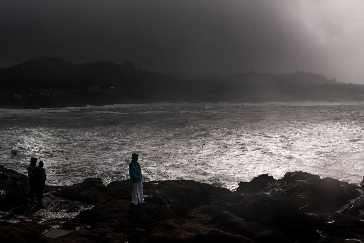
Two atmospheric river storm systems are bringing significant rain and snow to the Pacific Northwest and Northern California, with the first storm already delivering 1 to 2 inches of rain west of the Cascade Mountains. These storms, characterized by concentrated moisture, are expected to cause heavy flooding and mountain snow in the region.

An Easter weekend storm has hit Southern California, bringing more rain and mountain snow to the region, with 1 to 3 inches of rain and up to 2 feet of snow expected by Monday. The storm has prompted a flood watch in parts of San Luis Obispo, Santa Barbara, Ventura, and Los Angeles counties, and is forecast to bring showers, possible thunderstorms, damaging winds, and a tornado threat until Sunday night or into Monday.
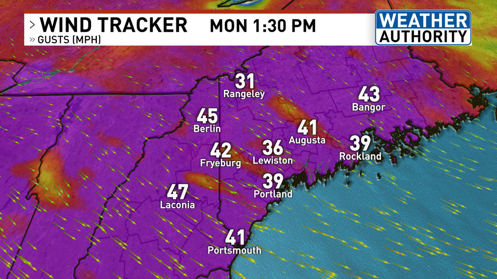
Very strong winds will continue in Maine on Monday, with gusts up to 50 mph outside of the mountains and over 50 mph in the mountains, potentially causing scattered power outages. Upslope snow will continue in the mountains with up to 8 inches of new snow possible. Minor coastal flooding is also expected during high tide. Quieter and milder weather is forecasted for the rest of the week, with calmer conditions on Tuesday, sunnier weather on Wednesday, and the potential for rain and snow on Friday.

A powerful storm is hitting Maine with heavy rain, strong winds, and mountain snow, causing thousands of power outages. Coastal flooding and difficult winter travel are expected, with improving conditions arriving Wednesday afternoon. Another potent storm is forecasted for the weekend, bringing heavy rain, strong winds, and mountain snow. The forecast for early next week also shows potential for more snow and travel impacts.
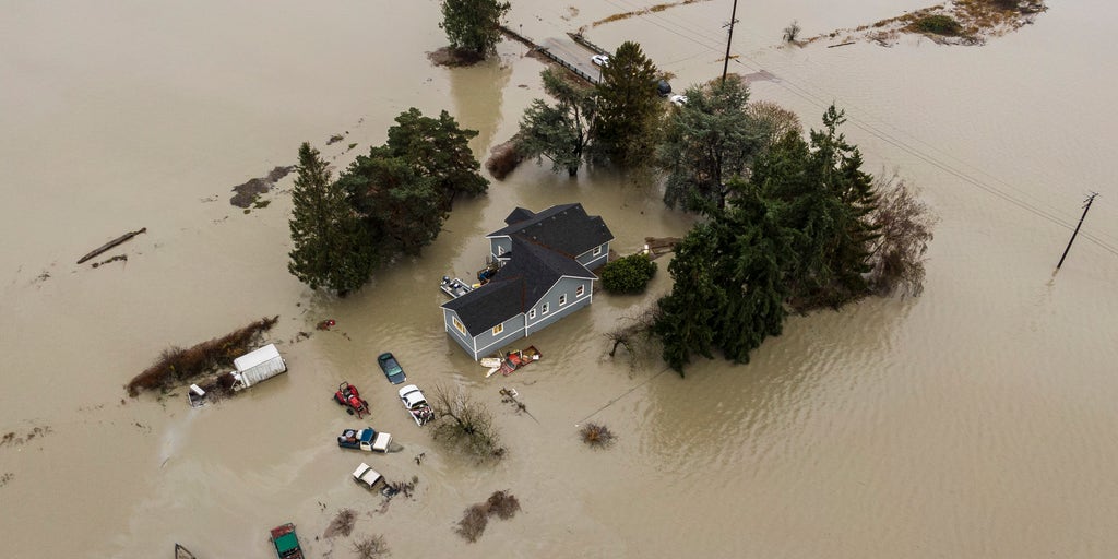
A new atmospheric river storm is set to hit the Pacific Northwest over the weekend, bringing heavy rain and mountain snow. This storm follows a previous Pineapple Express storm that caused flooding and record flood levels in the region. While this new storm is weaker and moving faster, it is expected to add more water to already swollen rivers. Snow levels will be lower, leading to less immediate water runoff, but travel challenges are expected in mountain passes. Up to 5 inches of rain and 10-15 inches of snow are forecasted, with a risk of minor flooding and moderate snow accumulations.

Washington state's mountains are expected to receive the first significant snowfall of the season, with 6-11 inches in the Olympics and potentially exceeding 20 inches in some areas. A colder weather system will bring gusty winds and temperatures dropping into the 30s, prompting a travel advisory and the need for a survival kit. Lowland areas will experience rain, while places like Bellingham may see a rain-snow mix without accumulation.
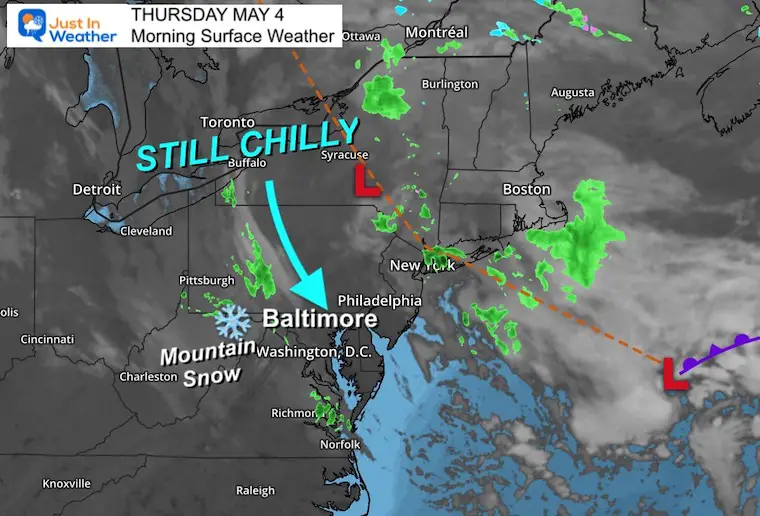
Unusual upper level pattern continues to bring chilly temperatures and unsettled air, producing clouds and showers. Inland areas may experience frost in the mornings. Historic record snowfall of 20.1 inches reported in West Virginia mountains. Temperatures will slowly warm up over the weekend, but showers and thunderstorms are expected on Monday and Tuesday. Meteorologist Justin Berk acknowledges spelling and grammar errors due to his dyslexia.
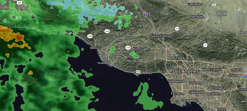
Southern California is expected to experience cooler and cloudier conditions with heavy rainfall, thunderstorms, and mountain snow overnight Wednesday through Thursday morning, according to the National Weather Service. Coastal and valley regions are forecast to receive half an inch to an inch of rainfall, while mountains and foothills may see 1-2 inches. Motorists should be cautious of minor roadway flooding and hazardous conditions due to slick streets. A warming trend is expected to take hold Friday through Monday.
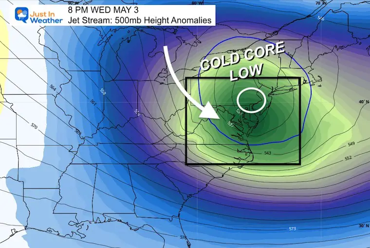
The upper level Low passing overhead today will make it the coolest day of the stretch, with the possibility of heavy showers, thunder, and icy stuff. The mountain snow update reports 10 inches of snow on Snowshoe, WV, with more expected overnight. The radar simulation shows snow continuing for the high mountains of Western Maryland and West Virginia, while pockets of heavy rain and squalls develop east of the mountains. Afternoon temperatures will stay in the lower 50s for most urban and bay areas, while colder inland suburbs will have a day in the 40s. The damp and chilly air will gradually disperse, with spotty rain showers on Thursday and dry weather on Friday into the weekend.
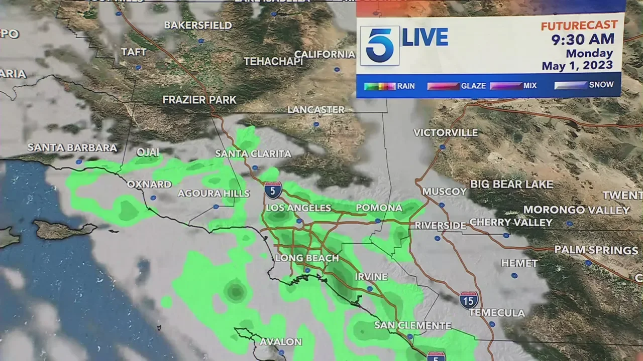
Southern California is expected to experience increased chances of rain and mountain snow from Tuesday through Thursday due to a late season storm. The storm will also bring gusty winds and a possibility of thunderstorms. Rainfall totals are forecast to be between 1/3-2/3 of an inch in coastal and valley regions and around an inch in the foothills and mountains. Snow levels during this period are forecast to drop to elevations of 4,500-5,500 feet, with a 50% chance of light snowfall over the Tejon Pass. Motorists should be cautious of minor roadway flooding and hazardous conditions due to slick streets.