Zealandia Revealed: Earth's Hidden Eighth Continent Emerges Beneath the South Pacific
New geological dating and magnetic data strengthen Zealandia's status as a distinct underwater continent, reshaping our understanding of Earth's ancient geography.
All articles tagged with #zealandia
New geological dating and magnetic data strengthen Zealandia's status as a distinct underwater continent, reshaping our understanding of Earth's ancient geography.
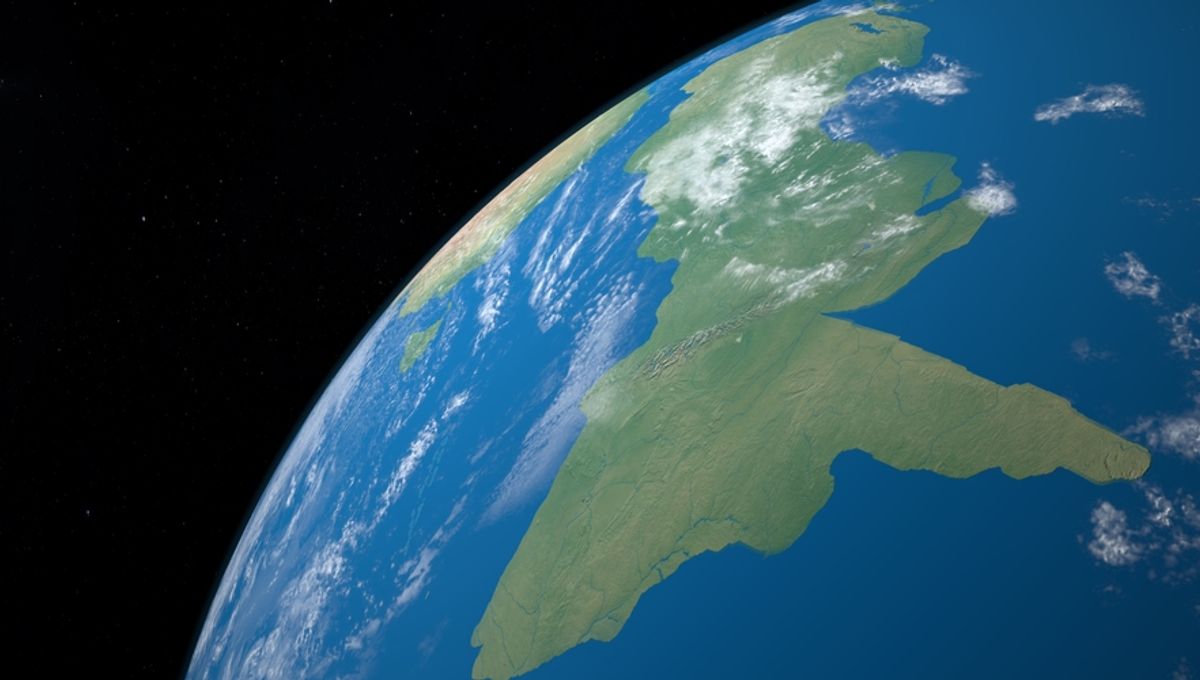
Scientists have formally recognized Zealandia as Earth's eighth continent—spanning about five million square kilometers with more than 94% submerged in the Pacific—after International Ocean Discovery Program drilling and peer‑reviewed studies showing it meets continental criteria (thicker crust, coherent landmass, and ancient terrestrial fossils). This confirmation reshapes our understanding of Earth’s crust and could influence future maritime claims and exploration.
Zealandia, Earth's long-lost eighth continent, has been officially recognized after decades of scientific debate, covering nearly 1.9 million square miles mostly submerged beneath the southwest Pacific Ocean, with significant implications for geology, resource claims, and our understanding of plate tectonics.
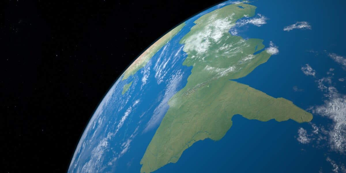
Zealandia, a largely submerged landmass beneath the Pacific Ocean, has been officially recognized as Earth's eighth continent after comprehensive mapping and research, revealing its unique geological features and history as part of Gondwana, with advanced technology enabling detailed exploration of its underwater terrain.
Scientists have confirmed Zealandia as Earth's eighth continent, a massive submerged landmass in the South Pacific that separated from Gondwana millions of years ago, with evidence from rock dating and magnetic data supporting its continental status.
Geologists have completed mapping Zealandia, a submerged landmass considered Earth's eighth continent, covering nearly two million square miles. The research involved analyzing rock samples from North Zealandia, revealing its geological history tied to the ancient supercontinent Gondwana. Despite being mostly underwater, Zealandia's mapping highlights its significance as a geological entity.
After 375 years, scientists have officially discovered the missing continent of Zealandia, which was once part of an ancient supercontinent. Initially theorized in Roman times and partially discovered in the 1600s, the continent is mostly underwater and roughly 1.89 million square miles in size. Zealandia, also known as Te Riu-a-Māui in the Māori dialect, had been hiding in plain sight and was part of the ancient supercontinent of Gondwana over 500 million years ago. Geologists from GNS Science made the discovery in 2017, shedding light on the continent's separation from the supercontinent and its submersion beneath the waves.
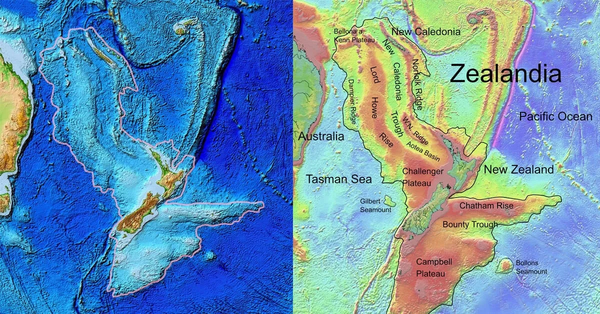
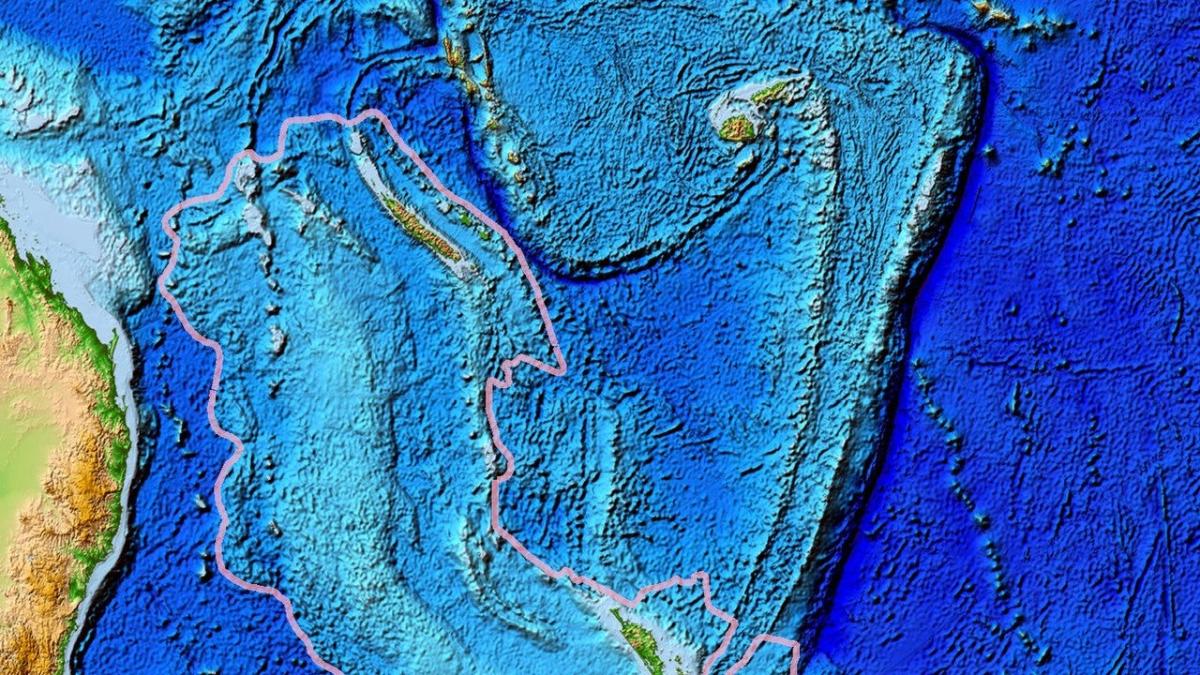
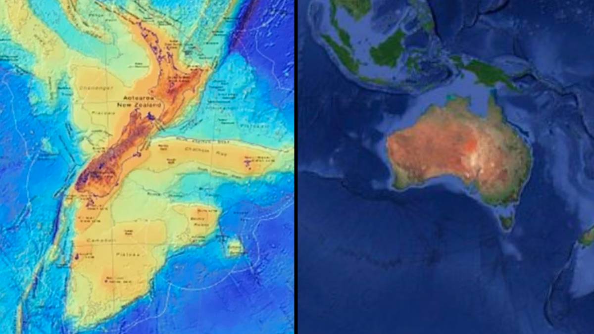
Geologists have discovered the submerged continent of Zealandia, twice the size of India, beneath the southwest Pacific Ocean. A new geological map has been compiled using rock samples and geophysical mapping methods, revealing large sandstone formations and basaltic rock pebbles that suggest Zealandia was gradually flooded around 40 million years ago. The study, "Reconnaissance basement geology and tectonics of North Zealandia," was published in the journal Tectonics in 2023.

Zealandia, the largely submerged continent near New Zealand, has been completely mapped by a team of geologists using rock samples and geophysical mapping methods. The continent, twice the size of India, was likely flooded around 40 million years ago. The mapping revealed large sandstone formations and basaltic rock pebbles, providing insights into Zealandia's geological history. This discovery sheds light on a previously unknown part of Earth's geography and geological evolution.
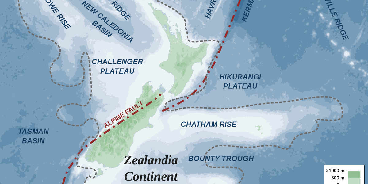
Zealandia, Earth's eighth continent, has been completely mapped for the first time, revealing ancient secrets such as a giant volcanic region that ignited when the continent broke off from Gondwana, and a 4000-kilometer-long granite backbone. The mapping, conducted by an international team of scientists, provides a comprehensive understanding of Zealandia's geological history and paves the way for further exploration and discovery.
Scientists have completed the first comprehensive mapping of Zealandia, a submerged continent in the South Pacific that was once part of a supercontinent 300 million years ago. By analyzing rock samples and magnetic maps, researchers have outlined the extent of Zealandia, which spans 1.9 million square miles and connects Antarctica and Australia. The study sheds light on how Zealandia formed and split from nearby landmasses, providing insights into Earth's continental evolution over vast timescales.
Scientists have confirmed the existence of Zealandia, a long-lost continent over a billion years old, located beneath New Zealand's South and Stewart Islands. Geologist Rose Turnbull and her team identified ancient zircon crystals in rock samples, leading to the discovery of continental crust fragments as old as 2.7 billion years. This research, published in the Geology journal, adds Zealandia as the youngest sibling among Earth's continents, with its crust not as old as those on other continents, which date back more than three billion years.
Geoscientists have discovered Zealandia, a continent that had been hidden for 375 years. Zealandia, also known as Te Riu-a-Māui, is approximately 1.89 million square miles in size and was part of the supercontinent Gondwana. It was first mentioned in 1642 by Dutch sailor Abel Tasman, but its existence was confirmed in 2017. Most of Zealandia is underwater, and it has only three territories. The discovery of Zealandia serves as an example of how something "very obvious" can take a long time to uncover.

Geoscientists have discovered Zealandia, a continent that had been hidden for 375 years. Zealandia, also known as Te Riu-a-Māui, is approximately 1.89 million square miles in size and was part of the supercontinent Gondwana. It was first mentioned in 1642 by Dutch sailor Abel Tasman, but its existence was confirmed in 2017. Most of Zealandia is underwater, and it has only three territories. The discovery of Zealandia serves as an example of how something "very obvious" can take a long time to uncover.

Geoscientists have discovered Zealandia, a continent that had been hidden for 375 years. Zealandia, also known as Te Riu-a-Māui, is approximately 1.89 million square miles in size and was part of the supercontinent Gondwana. It was first mentioned in 1642 by Dutch sailor Abel Tasman, but its existence was confirmed in 2017. Most of Zealandia is underwater, and it has only three territories. The discovery of Zealandia serves as an example of how something "very obvious" can take a long time to uncover.