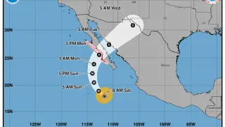
A teacher at Highland Middle School in Hobbs, New Mexico, was shot multiple times, causing community shock. Simultaneously, Hurricane Polo has weakened to a tropical depression as it crosses over the state.
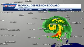
Tropical Depression Edouard, which made landfall near Johnson Bayou, LA, spreads gusty winds and heavy rain across southeast Texas as it weakens and moves slowly north-northwest, with expected rainfall of 4–8 inches (up to 12 inches in spots), potential flash flooding and a brief tornado risk in SW Louisiana and SE Texas, then dissipating tonight.
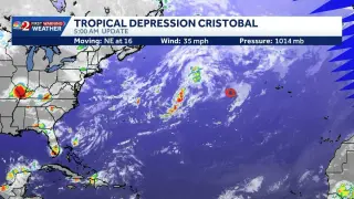
The National Hurricane Center downgraded Cristobal to a tropical depression about 610 miles west of the Azores, with maximum sustained winds around 35 mph and a northeast drift of roughly 16 mph; the system is expected to dissipate soon, and no coastal watches or warnings are in effect.
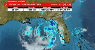
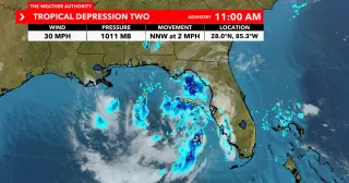
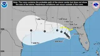
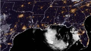
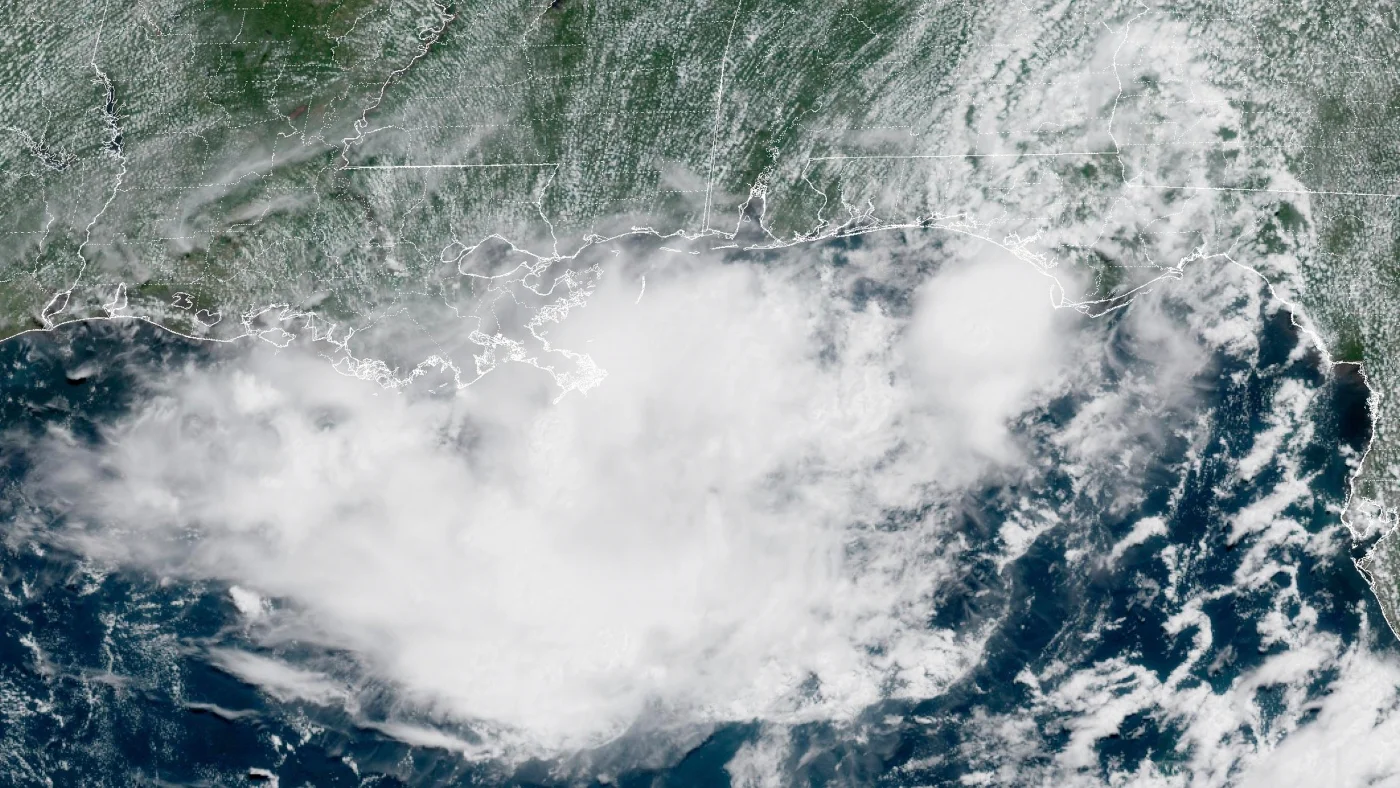
Tropical Depression Two has formed over the northeastern Gulf with a more defined center and 30 mph winds, moving northwest and bringing scattered thunderstorms and gusty winds; meteorologists expect Tropical Storm Bertha to form soon, bringing heavy rainfall to the northern Gulf Coast, with tropical-storm watches in effect from Ochlockonee River to the Florida/Alabama border; the system is not expected to intensify beyond a tropical storm.
Tropical Depression Two has formed in the northeastern Gulf with a defined center and 30 mph winds, moving NW and bringing scattered storms and gusty winds; Bertha is likely to form as a tropical storm as early as tomorrow morning along the Northern Gulf coast, with tropical-storm watches in effect from Ochlockonee River to the Florida/Alabama border.
A tropical depression formed off Florida along the Gulf Coast with a tropical-storm warning in effect for the Florida Panhandle through Monday night. Forecasters say it could become a tropical storm named Bertha, but strong Saharan dust and wind shear likely prevent hurricane formation; residents from Florida, Alabama, Mississippi and Louisiana should monitor the system for potential high winds and heavy rains.
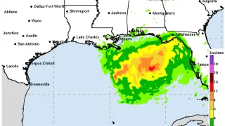
Tropical Depression Two formed off Florida and is expected to strengthen into Tropical Storm Bertha, with a tropical-storm watch issued from the Ochlockonee River to the Alabama border. The system could bring 1-3 feet of storm surge and 2-4 inches of rain (locally up to 8 inches) along the central/eastern Gulf Coast through Thursday, along with gusty winds and a flash-flood risk for parts of west-central and southwest Florida as it moves and potentially strengthens to around 60 mph. Land interaction adds uncertainty to forecast intensity and track. NOAA still projects a below-normal 2026 hurricane season with 8-14 named storms, 3-6 hurricanes, and 1-3 major hurricanes.
Invest 91L in the Gulf became Tropical Depression Two on July 19, with forecasts suggesting it could strengthen to a tropical storm and a Tropical Storm Watch issued for parts of the Florida Panhandle. The main threat is heavy rain and potential flash flooding along the northern Gulf Coast, with watches possible for Alabama, Mississippi, Louisiana, and Texas. The Air Force Hurricane Hunters will investigate later today, though Saharan dust and wind shear could limit development. Forecasters show an 80% formation chance in the next 48 hours to seven days, and residents should monitor updates as the system evolves.
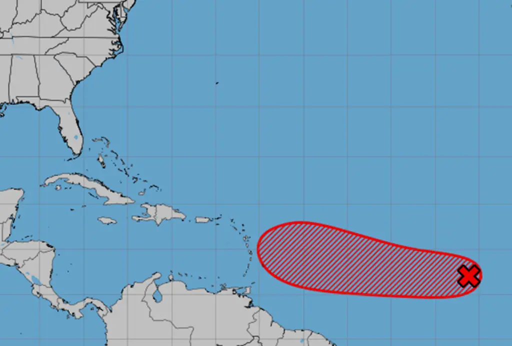
The National Hurricane Center is monitoring a developing system in the Atlantic, with a high chance of becoming a tropical depression or storm, potentially impacting the Caribbean and possibly threatening Florida, as it moves westward and could become Tropical Storm Gabrielle.
A weather system over Florida is likely to develop into a tropical depression and pose flooding risks to the Gulf Coast, especially Louisiana and New Orleans, with heavy rains expected and preparations underway amid recent severe floods in the region.
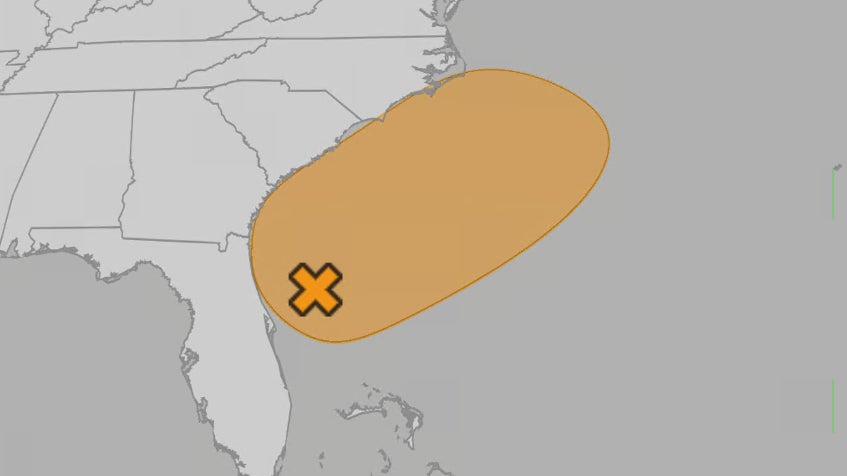
A potential tropical depression off the southeastern US coast could bring heavy rain and flash flooding to Florida and nearby states this weekend, with forecasters monitoring its development amid an above-average hurricane season influenced by climate change.
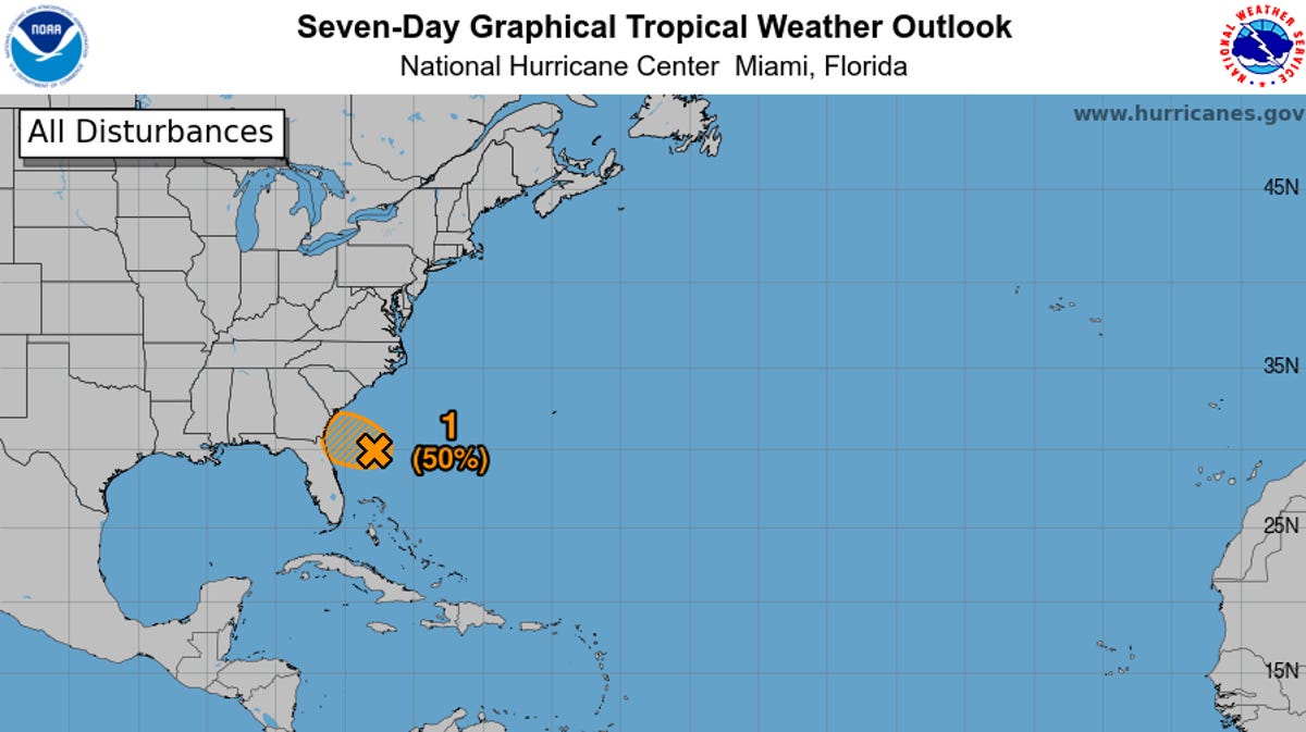
A 50% chance of a tropical or subtropical depression forming near Florida or off the Southeast coast over the holiday weekend, with stormy weather, gusty winds, and potential flash flooding expected across Florida, Georgia, and the Carolinas, regardless of whether a depression develops.
A tropical depression near southeast Mexico is expected to strengthen into a tropical storm and make landfall by Sunday night, bringing heavy rains to parts of Guatemala and Mexico.
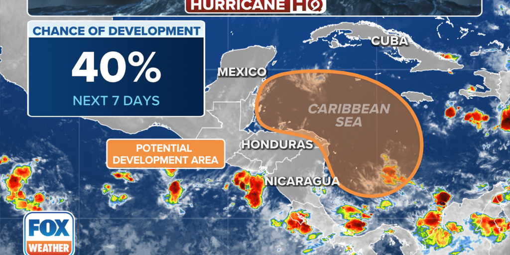
A broad area of low pressure is expected to form over the western Caribbean Sea, with potential to develop into a tropical depression later this week or weekend, as the 2024 Atlantic hurricane season nears its end. The National Hurricane Center is monitoring this system, giving it a medium chance of development over the next seven days. This follows the dissipation of Tropical Storm Rafael, which had previously been a major hurricane.
The National Hurricane Center is monitoring two disturbances that could develop into tropical depressions. Invest 92L, located off the northeastern Florida coast, may approach Florida or Georgia and bring heavy rain, gusty winds, and dangerous rip currents. Another disturbance in the southwestern Gulf of Mexico has a 60% chance of development and could become a tropical depression this weekend, potentially impacting the Gulf coast of Mexico.