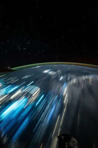
NASA astronaut Anil Menon shared a long-duration image from the International Space Station showing star trails above the Banda Sea. The photo, taken on September 20, 2026, highlights the contrast between celestial motion and the static lights of Indonesian cities and fishing boats below.
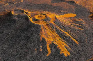
The NASA-ISRO Synthetic Aperture Radar (NISAR) satellite has produced a time-lapse video documenting the ongoing lava flow from Krasheninnikov volcano in Russia’s Kamchatka Peninsula. The eruption, triggered by an 8.8-magnitude earthquake on July 30, 2025, marked the first activity for the twin volcanoes in nearly 500 years. NISAR, launched on the same date as the earthquake, began monitoring the site in December 2025, capturing 17 high-resolution images through August 2026. The footage reveals lava filling an inner caldera, overflowing into a wider crater, and spreading eastward in a fan shape. This demonstrates NISAR’s capability to monitor remote natural hazards with high precision, offering a new tool for global volcanic surveillance.
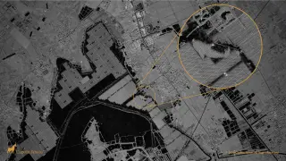
Earth observation is increasingly led by private players and AI, democratizing satellite data but also raising privacy, security and dual‑use concerns, including potential for misinformation from fake imagery. Companies like Space42 and ICEYE are building sovereign, dual‑use SAR constellations that enable rapid, decision‑grade intelligence and international collaboration, while governments lean on commercial analytics (e.g., TAC SRT) to respond quickly. Experts emphasize balancing private-sector innovation with governance and ethics, training the next generation to understand sensor physics and AI limits, and addressing the privacy and security risks that come with the data deluge.
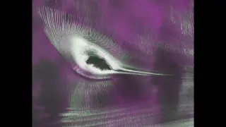
A NASA-ISRO NISAR radar image of an East Antarctic nunatak shows a vivid hummingbird-shaped pattern: the “bird” is not alive but formed by the mountain summit, glacier crevasses, and flowing ice, offering a glimpse into glacier movement beneath the surface; the data, released publicly starting July 20, highlights how radar can reveal hidden ice dynamics.
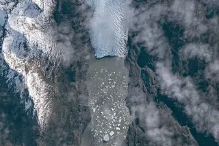
NASA's Earth Observatory showcases an ISS image of Tyndall Glacier in southern Chile, part of the Southern Patagonian Icefield, with icebergs drifting on Lago Geikie after recent calving. The glacier has shrunk since the Little Ice Age; Lago Geikie formed around 1940 as the ice retreated. Tyndall has lost about 2.2 km of length since Nov 2022 due to thinning and multiple calving events, including a major one in 2023. In May 2026 the front stood roughly 30–40 m above the lake, and scientists expect more iceberg production this fall as crevasses persist. Astronaut photography enables monitoring of remote glaciers like Tyndall and helps track ongoing climate-related changes.
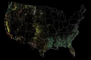
A NASA-funded analysis of 35 years of Landsat data finds that human-driven disturbances in the continental U.S. have declined since the late 1980s, while wild disturbances such as wildfires and hurricanes have increased, shifting the dominant forces shaping U.S. landscapes and underscoring the need for disaster-informed planning.
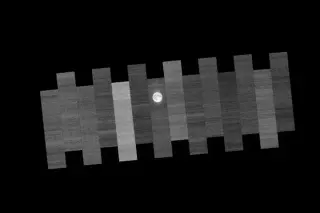
NASA’s Landsat 9 regularly points its sensors at the Moon during the full Moon to detect and correct drift, using the Moon’s stability as a reference to keep decades of Earth observations consistent, a process that runs alongside Artemis’ return to lunar exploration.
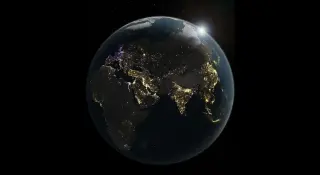
NASA’s satellite images reveal significant shifts in Earth's nighttime illumination, with rapid increases in lighting in growing urban centers across developing regions, signaling accelerating urbanization and energy use; the nighttime glow provides a new metric for tracking population trends and development over time.
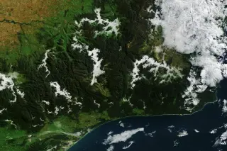
NASA’s Earth Observatory highlights autumn fog in eastern Victoria as the Terra satellite’s MODIS instrument captures morning valley fog in the Victorian Alps and an arch-shaped cloud drifting over Port Phillip Bay. The piece explains radiation fog forms when air cools to the dew point in calm conditions, sinks into valleys, and lingers where terrain shades the ground; nearby breezes interacting with the bay’s terrain likely shaped the arch cloud, which moved south as the fog faded.
NASA and IBM’s open-source Prithvi geospatial AI foundation model was uploaded to two in-orbit platforms—the Kanyini satellite and the ISS-mounted IMAGINE payload—making it the first geospatial foundation model deployed in space. Trained on 13 years of Landsat/Sentinel-2 data, Prithvi demonstrated flood and burn-scar detection and can be updated on orbit with small decoder packages, enabling faster Earth observation analyses and potential natural-language interactions with onboard instruments in the future.
SpaceX will launch 45 payloads on an overnight Falcon 9 rideshare from Vandenberg, headlined by Korea’s CAS500-2 Earth observation satellite, with 44 secondary satellites from multiple partners deployed into Sun-synchronous orbit. Booster B1071 is targeting a landing at LZ-4 after liftoff, marking another milestone for SpaceX’s reusable rocket program. The mission includes satellites from Exolaunch, Loft Orbital, IRIDE, True Anomaly, Planet Labs and others, illustrating growing international collaboration to increase on-orbit capacity.
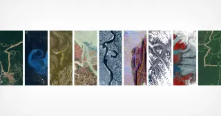
NASA, via its Kennedy Space Center and in partnership with the USGS, has promoted a Landsat-based tool that lets people spell out their name or any word using publicly available Landsat satellite imagery. The images are processed into false-color views that highlight environmental features, showcasing how letters can appear in natural landscapes (e.g., an “A” shape formed by Lake Mjøsa, Norway, and a lowercase “g” near Fonte Boa, Brazil) and noting Landsat’s long history of Earth observation since 1972. The feature, which first surfaced in Camp Landsat in 2024, is available online for users to try, illustrating how imagery can reveal patterns in land use and environment while offering a playful take on satellite data.
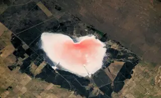
NASA's Earth Observatory released a striking image of a roughly 10-km-wide pink heart in Salinas Las Barrancas, Argentina, photographed from the International Space Station on January 16, 2024. The pink color comes from carotenoids produced by the microalga Dunaliella salina under intense light and high salinity; as evaporation raises salinity, dying cells feed halophilic archaea and bacteria that intensify the hue. The lake is an active salt-extraction site and the heart's shape is a geological accident, reflecting seasonal changes in this shallow brine environment.
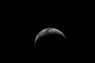
NASA marks Earth Day by recounting how Earth observation has advanced—from Apollo 8’s Earthrise to Artemis II’s Earthset—through radar and imaging missions like NISAR and INCUS, plus ongoing data from PACE and VIIRS, to monitor sea level rise, ice loss, weather, and urban growth and to inform agriculture, wildfires, droughts, floods, and other hazards.
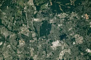
NASA’s Earth Observatory features an ISS image of the Capital Beltway’s northeast side near Greenbelt, Maryland, highlighting Greenbelt Park and surrounding green spaces amid suburban development, with nearby institutions like the Goddard Space Flight Center and University of Maryland noted; the photo, taken July 30, 2023, captures a landscape shaped by New Deal planning and ongoing preservation of green spaces.