Tag

Lidar

All articles tagged with #lidar

LiDAR reveals lost Maya city hidden in plain sight
science1 day ago

LiDAR reveals lost Maya city hidden in plain sight

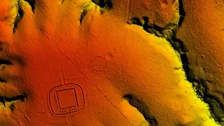
A Tulane PhD student, using LiDAR data from a Mexican environmental survey, uncovered Valeriana — a previously unknown Maya city in Campeche dating to roughly 750–850 AD and housing an estimated 30,000–50,000 people. The find shows tropical regions supported dense urban centers and demonstrates LiDAR’s power to digitally deforest landscapes to reveal thousands of structures; no on-site photographs exist yet, and researchers hope for more mapping to locate additional hidden cities.

Robot lawnmowers mature enough to tackle real yards
technology15 days ago

Robot lawnmowers mature enough to tackle real yards

Verge tester Jennifer Pattison Tuohy put five high-end robot mowers to the test on a large, tree-dotted yard and found that real-time kinematic (RTK) navigation—with NetRTK cloud support—plus lidar or vSLAM tech has largely eliminated the biggest pain points: getting stuck or wandering. The Segway Navimow X430 proved the most reliable and fastest, while other models like the Dreame A3 AWD Pro 2500 and Mammotion Luba 3 AWD 3000 showed strong performance with occasional quirks; budget Roborock RockNeo Q110H offered a lean option for smaller yards. Gate handling, obstacle avoidance, and the need for oversight persist, and price/durability remain concerns, but robot mowers have finally become a practical tool for maintaining lawns.

Newly Uncovered Mountainville Fault Tied to 2024 New Jersey Earthquake
science15 days ago

Newly Uncovered Mountainville Fault Tied to 2024 New Jersey Earthquake

A study in the Journal of Geophysical Research: Solid Earth identifies the Mountainville Fault near Tewksbury, NJ as a previously unmapped, immature basement fault that likely contributed to the April 2024 Mw4.8 quake near the Ramapo Fault. Using LiDAR topography, aftershock data, and lab friction tests, researchers tie the surface trace to a fault about 3.5 km west of the epicenter and warn that such hidden faults could pose important seismic hazards on the US East Coast, potentially triggered by local stress changes rather than Ramapo Fault slip alone.

US Drone Rules 2026: What’s Banned, What’s Still Sellable, What to Buy
technology18 days ago

US Drone Rules 2026: What’s Banned, What’s Still Sellable, What to Buy

The FCC has expanded its Covered List to bar the sale of all foreign-made drones and DJI cameras that aren’t FCC-certified, revoking approvals for several DJI clones and LiDAR-equipped devices. Drones and cameras already approved remain legal to sell and fly under FAA rules, but future models may be removed from the US market. For buyers, older DJI models and non-LiDAR drones that are already approved remain safer options; beginner picks include the DJI Flip or Potensic Atom 2, while experts might consider the DJI Mavic 4 Pro. The 249-gram threshold affects FAA registration, and importing unapproved drones can create compliance issues. There are a few US-made options for professional use, but consumer drones are largely still imported; parts for currently approved devices should continue to be available. The situation is evolving with ongoing litigation from DJI and anticipated further regulatory moves, including potential effects on Hasselblad equipment and model aircraft.

FCC Moves to Ban LiDAR-Equipped Drones It Previously Approved
technology19 days ago

FCC Moves to Ban LiDAR-Equipped Drones It Previously Approved

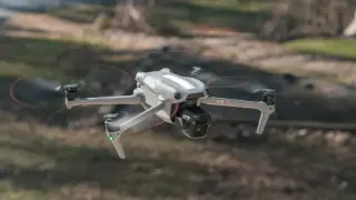
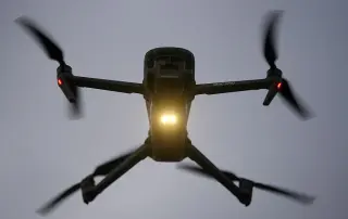
The FCC is proposing to extend its drone ban to include LiDAR-equipped models it had previously approved, potentially pulling DJI drones like the Air 3S and Mini Pro 5 from sale due to features such as LiDAR and thermal imaging. The ban would not affect drones already sold or owned, but could bar new units and affect commercial drones used for tasks like spraying or search-and-rescue. The agency is seeking public comments on the proposal until Sept. 2 as it broadens the government’s list of devices deemed a national-security risk. DJI has criticized the move as a reversal of the FCC’s prior stance.

FCC Moves to Retroactively Ban LiDAR-Equipped Drones, Sparking Regulatory Debate
technology21 days ago

FCC Moves to Retroactively Ban LiDAR-Equipped Drones, Sparking Regulatory Debate

The FCC announced a plan to retroactively revoke authorizations for what it calls “military-grade” drones, broadening the label to include consumer models with LiDAR obstacle avoidance such as DJI’s Air 3S, Avata 360, and Mini 5 Pro. If the policy remains after the Sept. 2 public-comment deadline, these drones could be removed from U.S. shelves, affecting photographers, filmmakers, first responders, farmers, and drone-delivery applications; the agency also flags other LiDAR- or thermal-equipped foreign drones and certain larger or docking-based devices. Public input via the FCC’s Electronic Comment Filing System is encouraged.

Lidar Reveals 400 Ancient Amazon Geoglyphs, Rewriting Regional History
science27 days ago

Lidar Reveals 400 Ancient Amazon Geoglyphs, Rewriting Regional History

A lidar survey across ~1,700 square miles of western Brazil’s Amazon uncovered nearly 400 earthworks dating from 600 BCE to AD 850, built by the Aquiry—a large, multicultural group estimated to number up to three million—indicating substantial ceremonial centers and settlements; as many as 20,000 geoglyphs may still lie hidden, with abandonment around AD 850–950 potentially linked to regional collapses seen in other civilizations.

Laser mapping reveals hundreds of Amazon geoglyphs built by the Aquiry civilization
science29 days ago

Laser mapping reveals hundreds of Amazon geoglyphs built by the Aquiry civilization

Airborne lidar surveying about 4,500 square kilometers in Brazil’s Acre state uncovered 396 new geoglyphs, shedding light on the Aquiry civilization that built monumental earthworks, longhouses, and ceremonial centers and farmed crops like maize and squash. The findings suggest a large, interconnected society that may have peaked at 1.25–3 million people between AD 100 and 300, with thousands of geoglyphs yet to be found and a probable collapse around AD 850–950.

Airborne lasers reveal a vast lost Amazonian civilization of millions
science29 days ago

Airborne lasers reveal a vast lost Amazonian civilization of millions

Airborne lidar scans across 1,737 square miles of western Brazil uncovered 400+ earthworks, roads, and geoglyphs linked to the Aquiry culture dating to about 2,500 years ago, implying a connected Amazonian civilization of 1.25–3 million people and a notable ecological footprint from maize and squash farming and forest management; published in Nature, the findings challenge the view of the Amazon as pristine and could reshape climate models, though population estimates are debated and more research is needed.

Remote Yucatán Jungle Uncovers a Row of Unlooted Maya Monuments
science1 month ago

Remote Yucatán Jungle Uncovers a Row of Unlooted Maya Monuments

Archaeologists in Mexico’s Yucatán Peninsula discovered 14 Maya monuments at the remote site of Minanbé, including a well-preserved 40‑foot temple and inscriptions dating to AD 849 and the late 600s. The untouched condition suggests little looting, highlighting the site's political importance as a regional town rather than a major city. Access required extensive jungle treks after ATV travel, with lidar helping to locate the site. Further excavations are planned to learn more about regional urbanization and the late‑classic Maya collapse; funding came from Slovenian agencies and private donors.

Heaven Sword of the Da’an River: Taiwan’s 84.1-meter giant crowned East Asia’s tallest tree
science2 months ago

Heaven Sword of the Da’an River: Taiwan’s 84.1-meter giant crowned East Asia’s tallest tree

Researchers in Taiwan identified the Heaven Sword of the Da’an River as East Asia’s tallest known tree, a 84.1-meter (276-foot) Taiwania fir about 1,000 years old, confirmed after a decade of aerial lidar surveys, map-based targeting, and final tape-drop measurements from the tree itself; the discovery highlights giant trees’ role in carbon storage and biodiversity and demonstrates how combining remote sensing with on-site verification can uncover Earth’s rare giants.

Lidar-Equipped, Budget-Friendly: Mammotion Luba 3 AWD 5000H Brings Auto Mowing to the Lawn
technology3 months ago

Lidar-Equipped, Budget-Friendly: Mammotion Luba 3 AWD 5000H Brings Auto Mowing to the Lawn

An in-depth hands-on with Mammotion’s Luba 3 AWD 5000H, which adds lidar and NetRTK to the affordable lawn-robot line, removing the need for a dedicated RTK base station by using cellular/Wi‑Fi corrections; it keeps the app-driven setup, stores maps on the mower itself, and pairs a larger 5000H battery with ongoing improvements for easier, set‑and‑forget mowing—though it’s pricier than the Luba 2 and still requires careful mapping for tricky yards.

LiDAR lasers trace space junk's footprint in the upper atmosphere
space3 months ago

LiDAR lasers trace space junk's footprint in the upper atmosphere

Scientists are using ground-based LiDAR to detect ablation from reentering space debris in the upper atmosphere. A lithium cloud linked to SpaceX’s Falcon 9 upper-stage reentry was observed, and Leibniz Institute researchers are testing a three-channel multi-species LiDAR to detect metals and propellant residues (e.g., copper, aluminum oxide, hydrogen fluoride). The findings suggest debris reentry is altering the mesosphere and upper stratosphere, with potential implications for the ozone layer as satellite megaconstellations grow; experts call for expanded monitoring and dedicated efforts to track space waste reentry.