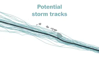
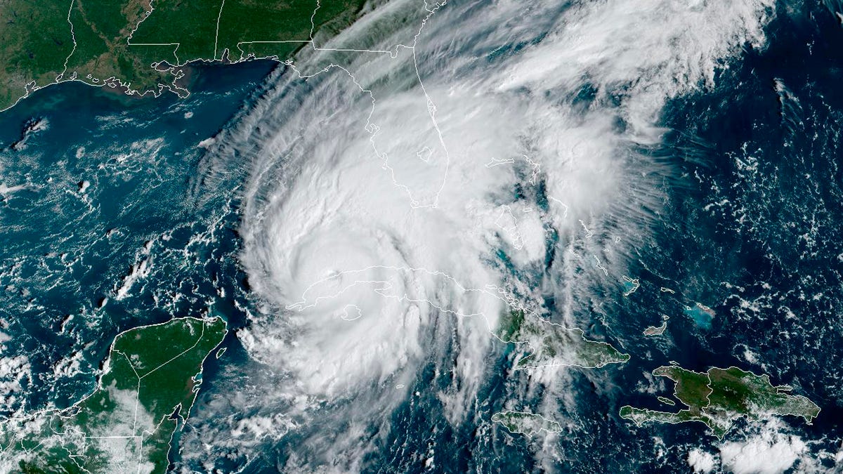
A forming tropical storm—Potential Tropical Cyclone One-C—is forecast to pass near Hawaii’s Big Island this weekend, with a 90% chance of strengthening into a tropical storm and the potential for heavy rain, damaging winds, and life-threatening flooding.
Nature reports WeatherNext Cyclones (WN-C), an AI-powered operational weather model that generates state-of-the-art ensemble forecasts for the track, intensity, and size of tropical cyclones worldwide. Trained on global analysis data and historical cyclones, WN-C produces ensembles up to 1,000 members up to 15 days ahead, delivering about a day or more of lead time improvement over leading models. The system shows that high-resolution input is not strictly required for strong intensity forecasts, and that including WN-C in a weighted ensemble improves overall skill, marking a step-change toward more reliable and timely forecasts and warnings.
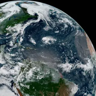
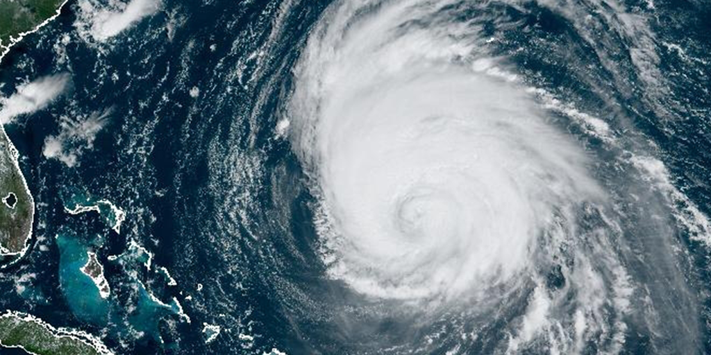
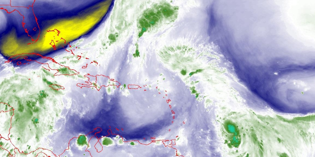
A Washington Post meteorologist explains that the Atlantic has been unusually quiet this hurricane season thanks to El Niño-driven upper-level winds and Saharan dust, making it one of the tamest seasons on record. But the season is long, and storms can still form, especially away from El Niño’s strongest winds, so vigilance remains essential as the peak approaches.
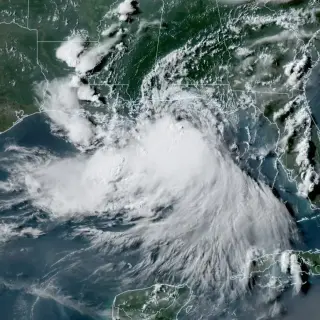
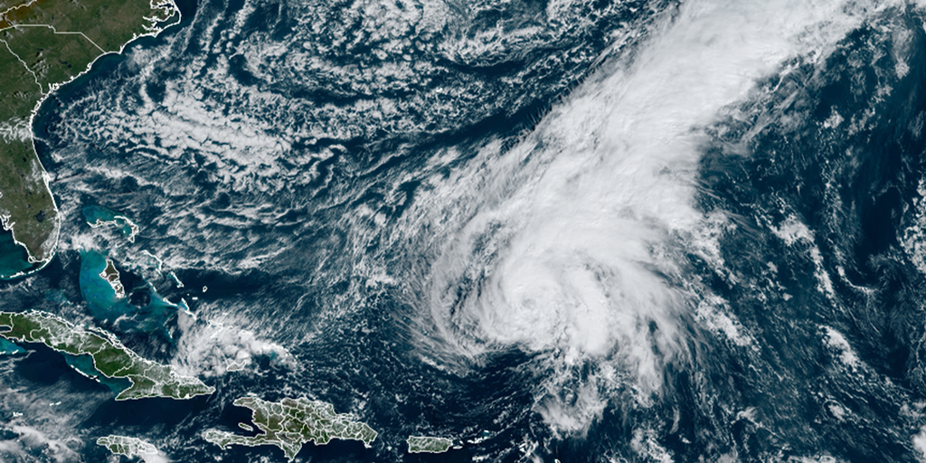
Bertha, the season’s second Atlantic storm, is approaching Louisiana and is forecast to make landfall Wednesday along the Gulf Coast, bringing storm surge, gusty winds and slow-moving downpours; as of 5 a.m. it was about 110 miles southeast of New Orleans with winds near 50 mph and a westward drift of about 5 mph.
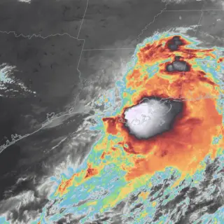
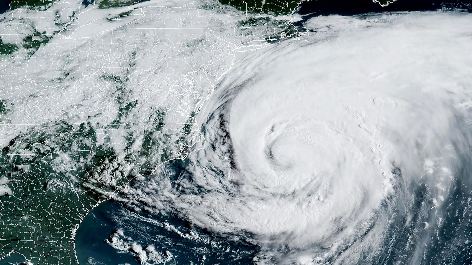
Arthur’s remnants—though downgraded from a tropical storm—bring heavy rain (6–9 inches so far) and a growing flood threat from Texas through eastern Louisiana, Mississippi and Alabama, with NOAA warning of life‑threatening flash floods and possible tornadoes as the system moves inland and more downpours could follow.
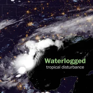
A waterlogged tropical disturbance near Texas has a 60% chance of developing into a tropical storm and could dump heavy rain from eastern Texas to the Carolinas. Flood watches are in effect from Texas to Mississippi as severe thunderstorms move along the Gulf Coast; forecasters warn copious moisture could drench a wide area from Houston to Atlanta and into Louisiana, Mississippi and Alabama with significant impacts possible depending on storm development.
The Atlantic hurricane season is at its peak around September 10, with activity expected to increase in the coming weeks despite current quiet conditions. Forecasters predict a rise in tropical cyclone development later in September and October due to favorable environmental factors, with NOAA forecasting above-normal activity and an increase in named storms, hurricanes, and major hurricanes. Historically, late September and early October are among the most active periods for hurricanes, especially in the Caribbean and Gulf regions.
Colorado State University experts predict that the 2024 Atlantic hurricane season will be extremely active, with 23 named storms, 11 hurricanes, and 5 major hurricanes expected due to an impending La Niña. The warm Atlantic and weakening El Niño are contributing to the forecast, with a 62% chance of a major hurricane making landfall along the U.S. coastline. The National Hurricane Center plans to introduce an experimental forecast cone and more Spanish-language products for the upcoming season, which officially begins on June 1.
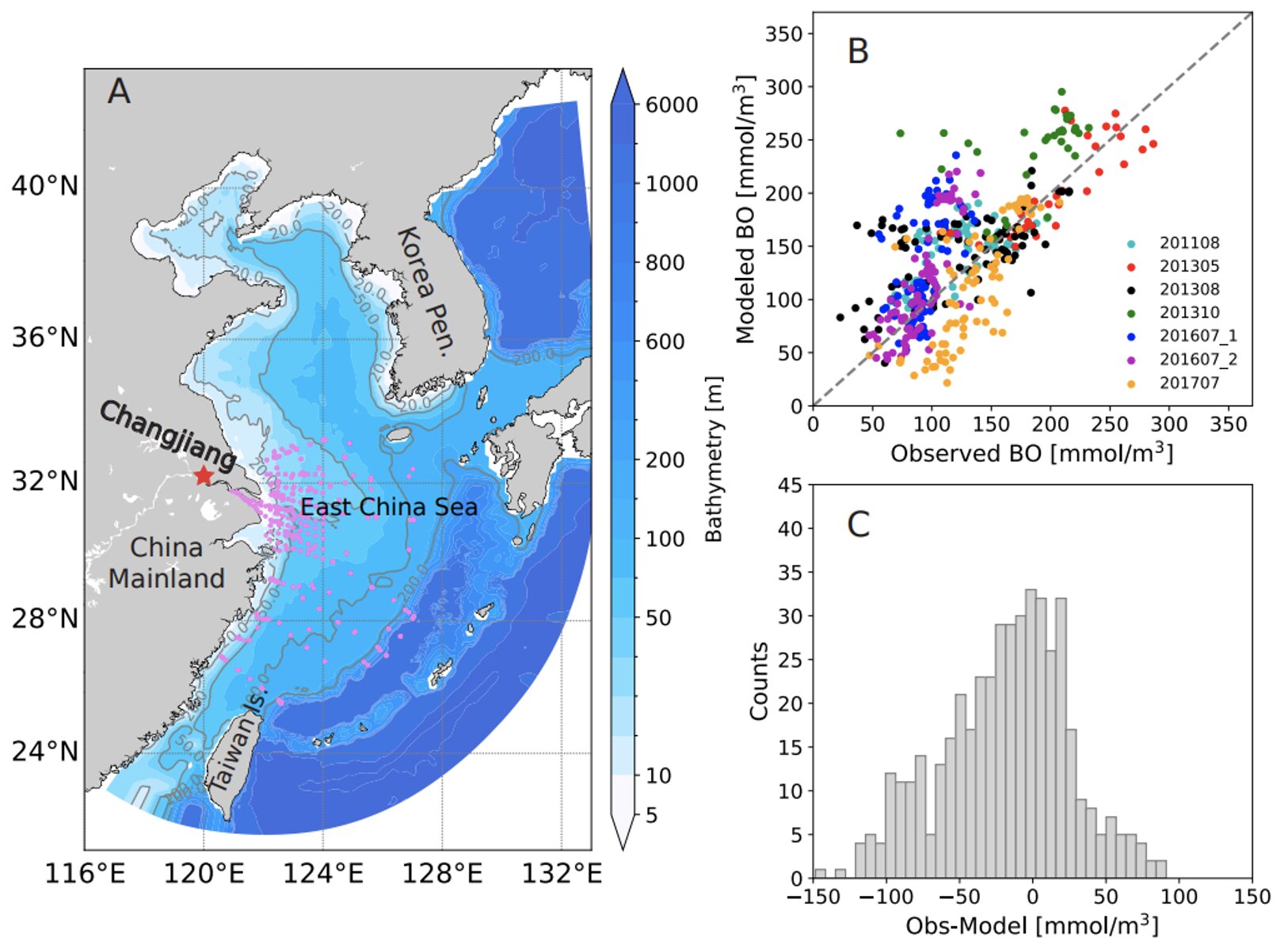
New research suggests that tropical cyclones have a net positive impact on ocean oxygenation and primary productivity in the East China Sea, countering issues of deoxygenation and hypoxia caused by human activities. The study found that tropical cyclones lead to increased oxygen levels and enhanced marine trophic webs, despite their devastating consequences on land. As climate change continues, the frequency of these events is likely to increase, presenting a paradoxical situation where tropical cyclones, while destructive on land, may benefit the marine realm.
The 2024 hurricane season in the Atlantic basin is approaching, and forecasters are closely monitoring the El Niño-Southern Oscillation (ENSO) climate pattern to predict tropical cyclone activity. Early indications suggest a neutral or La Niña status for the upcoming season, potentially leading to more active hurricane activity. The National Hurricane Center plans to introduce changes, including experimental forecast cones and more frequent adjustments to watches and warnings. However, experts caution against preseason hype, emphasizing the unpredictability of hurricane activity and the limitations of long-term forecasts. The official list of names for the 2024 tropical cyclone season has been released, with retired names replaced by new ones.
As the hurricane season approaches its final month, the impact of the strengthening El Niño on the season's activity remains uncertain. While El Niño is typically associated with decreased hurricane activity in the Atlantic, this year has seen 20 storms and six hurricanes, contrary to expectations. Factors such as the Madden-Julian Oscillation and climate change may have a more significant influence on the season than El Niño. Climate experts suggest that traditional weather patterns are evolving due to climate change, making it challenging for forecasters to predict the level of activity in the remaining weeks of the season.
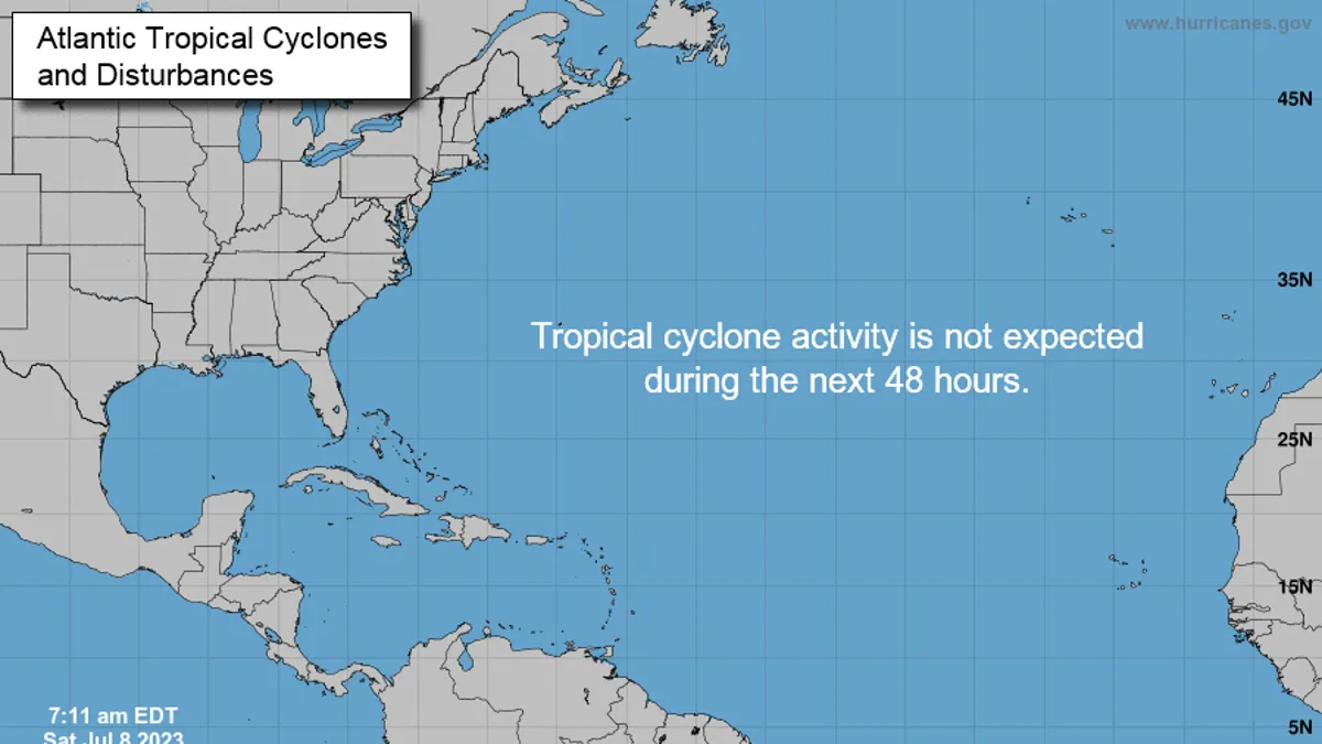
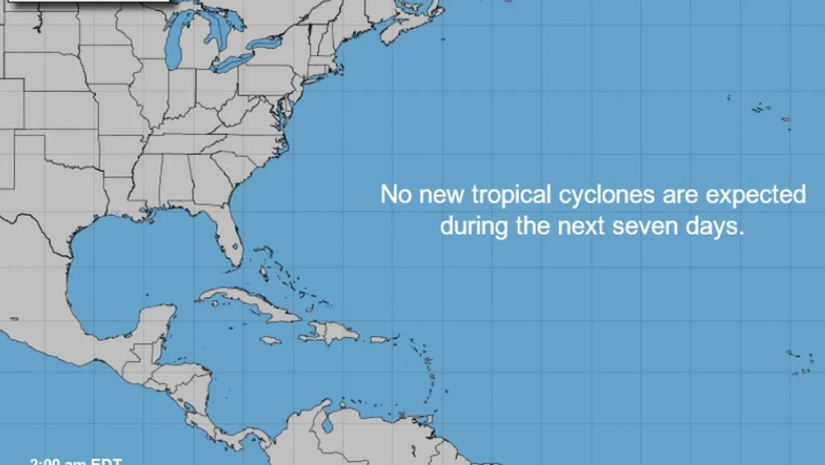
The National Hurricane Center (NHC) does not expect any tropical cyclone activity in the North Atlantic, Caribbean, or Gulf of Mexico for the next seven days. However, the NHC warns that Saharan dust from Africa could impact Florida and the Gulf Coast, potentially affecting air quality and triggering respiratory symptoms. While four tropical waves are being monitored, none are predicted to develop into organized storms. Residents are advised to stay vigilant and monitor the tropics.
The National Hurricane Center has stated that no tropical cyclones are expected over the next seven days, indicating that the Atlantic hurricane season is unlikely to start early this year. The season officially begins on June 1 and runs through Nov. 30, with the peak of the season being Sept. 10. The NOAA has predicted a 'near normal' hurricane season with 12-17 named storms and 5-9 hurricanes. Forecasters urge residents to continue monitoring the tropics and to always be prepared.
The Atlantic hurricane season officially runs from June 1 to Nov. 30 each year, with the primary time of year for hurricanes to form being from midsummer to midautumn. An average Atlantic hurricane season has 14 named storms, of which seven become hurricanes. Forecasters predict a near- to slightly below-average year for hurricanes in the Atlantic due to the influence of an expected El Niño. The eastern Pacific hurricane season runs from May 15 to Nov. 30, with an average of 15 named storms, eight hurricanes, and four major hurricanes.
Hurricanes almost never form at the equator due to the Coriolis effect, which controls the direction in which tropical cyclones spin. The Coriolis effect is weak near the equator but becomes stronger as latitude increases. Higher latitudes have faster-spinning winds to help drive tropical cyclone growth. Climate change does not significantly affect the rotation of the Earth, so it won't directly impact the chances of a hurricane crossing the equator.