A historic Super El Niño is intensifying and is expected to push New England toward a warmer, wetter winter, bringing more frequent storms but not necessarily more snow, with variability influenced by climate change.
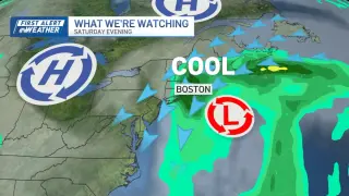
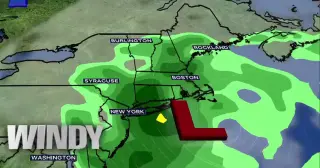
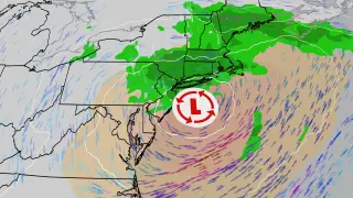
A slow-moving summer storm drenches the Northeast, expanding flash flood warnings into New England with 2–7 inches of rain forecast across the region. More than 11 million people are under flood watches as rescues, road closures, and flight cancellations mount from New Jersey to New England. The greatest risk is in parts of Massachusetts, Vermont and Connecticut, where Level 3 of 4 flood risk is in place, with heavy rain expected to continue into Wednesday before the system weakens and rain becomes more scattered.
A thick plume of wildfire smoke from Ontario and northern Minnesota has drifted into New England, triggering air quality alerts across the region. In Boston, the air quality index rose to about 130, deemed unhealthy for sensitive groups, with guidance to limit outdoor activity for those with asthma or COPD. Forecasters expect a second wave of smoke Thursday afternoon, bringing more ground-level haze and vivid sunsets as the smoky plume lingers.
A plume of wildfire smoke from northern Minnesota and Ontario is drifting into the Northeast due to a favorable jet stream, mostly remaining aloft and not significantly impacting ground-level air quality. Expect hazy, milky skies and slightly cooler afternoons, with unusually vibrant sunsets as smoke scatters light; surface mixing could bring a passing smoky smell. Track the plume with the 1DegreeOutside app.
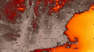
A heat dome will push temperatures into the 90s and 100s across southern New England this week, triggering an Extreme Heat Warning from Wednesday through Saturday (the Fourth of July) for parts of Massachusetts and Rhode Island. The heat index could reach around 109°F due to high dew points, with conditions hottest Thursday; beaches may stay cooler near the coast, and residents should take heat-safety precautions.
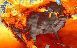
A stagnant heat dome will drive a broad heat wave across the eastern U.S. during the Fourth of July week, with temperatures forecast to reach the upper 90s to around 100°F in New England—Boston included—while humidity raises heat indices. Monday and Tuesday look milder, but by midweek the heat ramps up and is expected to peak by the weekend, prompting warnings and cautions to stay cool and hydrated.
Powassan virus, a rare tick‑borne illness, is being diagnosed more often in the northeastern U.S., especially New England, carried by blacklegged (deer) ticks and can cause neuroinvasive disease. Its roots trace to a 4-year-old boy’s fatal illness near Powassan, Ontario, in 1958, linking the virus to ticks on a farm. In 2025, 76 Americans were diagnosed—a record—primarily in New England and the Upper Midwest. Prevention centers on tick checks, protective clothing, prompt tick removal, and deer-management efforts, though there is no simple fix for the growing tick problem.
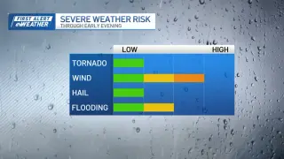
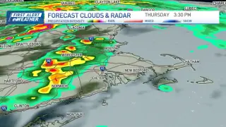
A rare tornado watch covers parts of New England today as thunderstorms could turn severe this afternoon. The threat depends on a warm front lifting north and sufficient instability; strongest activity is expected in Vermont and western Massachusetts/Connecticut, with damaging winds (up to ~45 mph) and a possible brief tornado if storms organize. The window for impact is roughly noon to 9 p.m., so stay weather-aware.
A tornado watch is in effect from 10 a.m. to 3 p.m. for parts of western Massachusetts and Vermont as strong to severe thunderstorms move through New England, capable of damaging winds, small hail and heavy rainfall; a brief isolated tornado cannot be ruled out. If enough sunshine breaks through, the threat could rise across central/eastern Massachusetts and southern New Hampshire. Expect gusty winds around 40 mph, with flash flooding possible in parts of New Hampshire and Maine; Vermont is under wind advisories with gusts up to 50 mph. Showers and storms should diminish after dinner, with weekend highs in the 70s to 80s.
As tick season peaks in New England, emergency visits for tick bites are rising and cases of tick-borne illnesses such as Lyme disease and alpha-gal syndrome are increasing, but experts emphasize that outdoor activity can continue with proven prevention strategies to minimize tick encounters.
NASA confirmed a bright daytime fireball meteor, about 5 feet (1.6 meters) in diameter, exploded over the northeastern United States on May 30, releasing energy roughly equal to 230 tons of TNT. The object streaked through the atmosphere at about 42,000 mph (67,000 km/h), broke the sound barrier about 31 miles up, and debris rain fell over Cape Cod. An NOAA satellite captured the event, and there were no injuries or property damage reported, though residents heard a loud sonic boom. NASA notes such small meteors are common and pose little risk to cities.
A roughly 3-foot-wide meteor brightened the daytime sky near the Massachusetts–New Hampshire border on Saturday, with loud double booms heard from Delaware to Montreal. NASA says it was natural material, likely breaking apart about 40 miles up at ~75,000 mph, releasing energy around 300 tons of TNT. Most fragments burned up; no confirmed ground impact, though shaking was reported and videos showed the fireball crossing the region. USGS did not record an earthquake event nearby.
A meteor exploded high over northeastern United States, releasing an energy equivalent to about 300 tons of TNT. The fireball traveled roughly 75,000 mph at an altitude of ~40 miles, not tied to a debris re-entry or a meteor shower. The resulting airburst generated loud booms that rattled homes and blew out windows across hundreds of square miles, injuring around 1,600 people. By comparison, the 2013 Chelyabinsk event released far more energy (around 440,000 tons).
A meteor was observed over New England, with reports of ground shaking felt in Massachusetts and Rhode Island; there were no immediate reports of injuries or major damage, and officials indicated more details would follow.
A cool May delayed the release of tree pollen across New England, but grass pollen is now surging and keeping allergy levels high. Pollen has been medium or high for 13 of the last 15 days, and May typically blends grass and tree pollen in Greater Boston. Experts warn that pollen levels will remain high through much of the summer as grass, ragweed, and mold rise, with Boston’s allergy season lengthened by more than two weeks since 1970.