SpaceWeather.com Turns 11,000 Starlink Satellites Into a Daily Atmospheric Barometer
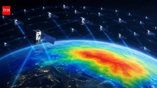
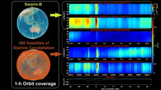
SpaceWeather.com has developed a daily 'Satellite Drag' index that uses public tracking data from over 11,000 Starlink satellites to measure Earth's upper atmospheric density. By analyzing the B-star drag terms in orbital elements, the index quantifies how much air density has changed relative to quiet days, providing a real-time barometer for space weather. The method is validated against independent constellations, including Planet Labs Doves and Amazon Kuiper, showing a 94% correlation with Starlink data. In 2026, the sink rate at 480 km ranged from 19.7 meters per day in August to 127.6 meters per day during a January geomagnetic storm. This daily metric helps calibrate orbit prediction models, which currently suffer from 20-30% errors in density estimates, and offers a new tool for collision avoidance as low Earth orbit becomes increasingly crowded.